Our website is made possible by displaying online advertisements to our visitors.
Please consider supporting us by disabling your ad blocker.
Debagarh district
Debagarh district
Deogarh | |
|---|---|
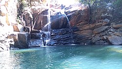
 Deojharan waterfall | |
 Location in Odisha | |
| Coordinates: 21°31′59″N 84°43′59″E / 21.533°N 84.733°E | |
| Country | |
| State | |
| Established | 1 January 1994 |
| Headquarters | Deogarh |
| Government | |
| • Collector | Somesh Kumar Upadhyay IAS |
| Area | |
• Total | 2,781.66 km2 (1,074.00 sq mi) |
| • Land | 2,150 km2 (830 sq mi) |
| Population (2011)[1] | |
• Total | 312,520 |
| • Rank | 30 |
| • Density | 106/km2 (270/sq mi) |
| Languages | |
| • Official | Odia, English |
| • Local | Munda, Kurukh |
| Time zone | UTC+5:30 (IST) |
| PIN | 768108 |
| Vehicle registration | OD-28 |
| Sex ratio | 976 ♂/♀ |
| Literacy | 73.07% |
| Vidhan Sabha constituency | 1, Deogarh |
| Climate | Aw (Köppen) |
| Precipitation | 1,014.2 millimetres (39.93 in) |
| Website | www |
Debagarh District also known as Deogarh District is a district of Odisha state, India. Located in the north-western part of the state, it is one of Odisha's 30 administrative districts and has its headquarters at Debagarh (Deogarh) town.
The district covers an area of 2781.66 km² and has a population of 312,520 (2011 Census). As of 2011, it is the least populous district of Odisha (out of 30).[1]
Previous Page Next Page


