Our website is made possible by displaying online advertisements to our visitors.
Please consider supporting us by disabling your ad blocker.
Diakopto
Diakopto
Διακοπτό | |
|---|---|
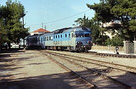
 Diakopto station in 1992 (metric gauge line no longer in use). | |
| Coordinates: 38°11′N 22°11′E / 38.183°N 22.183°E | |
| Country | Greece |
| Administrative region | West Greece |
| Regional unit | Achaea |
| Municipality | Aigialeia |
| Districts | 12 |
| Area | |
| • Municipal unit | 103.93 km2 (40.13 sq mi) |
| Elevation | 52 m (171 ft) |
| Population (2021)[1] | |
| • Municipal unit | 5,603 |
| • Municipal unit density | 54/km2 (140/sq mi) |
| • Community | 1,977 |
| Time zone | UTC+2 (EET) |
| • Summer (DST) | UTC+3 (EEST) |
| Postal code | 250 03 |
| Area code(s) | 24230 |
| Website | www.diakopto.gov.gr |
Diakopto (Greek: Διακοπτό) is a coastal town in Achaea, West Greece, Greece. Since the 2011 local government reforms it is a municipal unit of the Aigialeia municipality.[2] The municipal unit has an area of 103.932 km2.[3] The town of Diakopto is situated on the Gulf of Corinth, near the mouth of the Vouraikos river and at the lower end of the Vouraikos Gorge. The 750 mm (2 ft 5+1⁄2 in) gauge Diakofto–Kalavryta Railway built in 1885 leads up to the town of Kalavryta passing the Mega Spilaio Monastery at about halfway. Diakopto is on the old Greek National Road 8 (Athens - Corinth - Patras); the new Greek National Road 8A (also Athens - Corinth - Patras) passes 1 km to the south. Diakopto is located about 40 km east of Patras, and 15 km southeast of Aigio.
- ^ "Αποτελέσματα Απογραφής Πληθυσμού - Κατοικιών 2021, Μόνιμος Πληθυσμός κατά οικισμό" [Results of the 2021 Population - Housing Census, Permanent population by settlement] (in Greek). Hellenic Statistical Authority. 29 March 2024.
- ^ "ΦΕΚ B 1292/2010, Kallikratis reform municipalities" (in Greek). Government Gazette.
- ^ "Population & housing census 2001 (incl. area and average elevation)" (PDF) (in Greek). National Statistical Service of Greece. Archived from the original (PDF) on 2015-09-21.
Previous Page Next Page


