Our website is made possible by displaying online advertisements to our visitors.
Please consider supporting us by disabling your ad blocker.
Dinkelland
Dinkelland | |
|---|---|
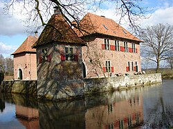
 Castle in Dinkelland | |
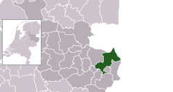
 Location in Overijssel | |
| Coordinates: 52°22′N 7°0′E / 52.367°N 7.000°E | |
| Country | Netherlands |
| Province | Overijssel |
| Government | |
| • Body | Municipal council |
| • Acting Mayor | John Joosten (VVD) |
| Area | |
• Total | 176.83 km2 (68.27 sq mi) |
| • Land | 175.71 km2 (67.84 sq mi) |
| • Water | 1.12 km2 (0.43 sq mi) |
| Elevation | 26 m (85 ft) |
| Population (January 2021)[4] | |
• Total | 26,606 |
| • Density | 151/km2 (390/sq mi) |
| Time zone | UTC+1 (CET) |
| • Summer (DST) | UTC+2 (CEST) |
| Postcode | Parts of 7500 and 7600 ranges |
| Area code | 0541, 074 |
| Website | www |

Dinkelland (Dutch pronunciation: [ˈdɪŋkəllɑnt] ⓘ) is a municipality in the eastern Netherlands. For a short time it was known as Denekamp (one of its component towns) until it was renamed in 2002.
- ^ "Ineke Bakker (acting mayor)" (in Dutch). Gemeente Dinkelland. Archived from the original on 2 February 2017. Retrieved 27 March 2014.
- ^ "Kerncijfers wijken en buurten 2020" [Key figures for neighbourhoods 2020]. StatLine (in Dutch). CBS. 24 July 2020. Retrieved 19 September 2020.
- ^ "Postcodetool for 7591MA". Actueel Hoogtebestand Nederland (in Dutch). Het Waterschapshuis. Retrieved 27 March 2014.
- ^ "Bevolkingsontwikkeling; regio per maand" [Population growth; regions per month]. CBS Statline (in Dutch). CBS. 1 January 2021. Retrieved 2 January 2022.
Previous Page Next Page


