Our website is made possible by displaying online advertisements to our visitors.
Please consider supporting us by disabling your ad blocker.
Elizabethton Municipal Airport
Elizabethton Municipal Airport | |||||||||||
|---|---|---|---|---|---|---|---|---|---|---|---|
| Summary | |||||||||||
| Airport type | Public | ||||||||||
| Owner | City of Elizabethton | ||||||||||
| Serves | Elizabethton, Tennessee | ||||||||||
| Elevation AMSL | 1,593 ft / 485 m | ||||||||||
| Coordinates | 36°22′16″N 082°10′24″W / 36.37111°N 82.17333°W | ||||||||||
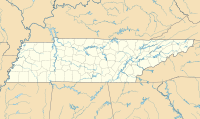
| Map | |||||||||||
 | |||||||||||
| Runways | |||||||||||
| |||||||||||
| Statistics (2020) | |||||||||||
| |||||||||||
Elizabethton Municipal Airport (FAA LID: 0A9) is three miles east of Elizabethton, in Carter County, Tennessee.[1] The National Plan of Integrated Airport Systems for 2011–2015 categorized it as a general aviation airport.[2]
- ^ a b FAA Airport Form 5010 for 0A9 PDF. Federal Aviation Administration. Effective August 10, 2023.
- ^ "2011–2015 NPIAS Report, Appendix A (PDF, 2.03 MB)" (PDF). National Plan of Integrated Airport Systems. Federal Aviation Administration. October 4, 2010. Archived from the original (PDF) on 2012-09-27.
Previous Page Next Page


