Our website is made possible by displaying online advertisements to our visitors.
Please consider supporting us by disabling your ad blocker.
Erosion surface

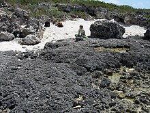
In geology and geomorphology, an erosion surface is a surface of rock or regolith that was formed by erosion[1] and not by construction (e.g. lava flows, sediment deposition[1]) nor fault displacement. Erosional surfaces within the stratigraphic record are known as unconformities, but not all unconformities are buried erosion surfaces. Erosion surfaces vary in scale and can be formed on a mountain range or a rock.[2] Particularly large and flat erosion surfaces receive the names of peneplain, paleoplain, planation surface or pediplain. An example of erosion surface is road surface erosion which is caused by natural and anthropogenic factors. Erosion surface can be measured through direct, contact measurement methods and indirect, non-contact measurement methods.
- ^ a b Lidmar-Bergström, Karna. "erosionsyta". Nationalencyclopedin (in Swedish). Cydonia Development. Retrieved June 22, 2015.
- ^ Toy, Terrence J.; Foster, George R.; Renard, Kenneth G. (2002). Soil erosion : processes, prediction, measurement, and control. New York: John Wiley & Sons. ISBN 0471383694. OCLC 48223694.
Previous Page Next Page


