Our website is made possible by displaying online advertisements to our visitors.
Please consider supporting us by disabling your ad blocker.
Fars province
This article's lead section may be too short to adequately summarize the key points. (December 2024) |
Fars
استان فارس | |
|---|---|
|
Clockwise from top right: the Tomb of Cyrus the Great in Pasargadae; Arg of Karim Khan in Shiraz; a canola field in Alamarvdasht; Bishapur valley; Naqsh-e Rostam; and Persepolis | |
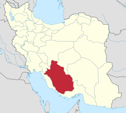
 Location of Fars province within Iran | |
| Coordinates: 29°25′N 53°14′E / 29.417°N 53.233°E[1] | |
| Country | |
| Region | Region 2 |
| Capital | Shiraz |
| Counties | 37 |
| Government | |
| • Governor-general | Hossein-Ali Amiri |
| Area | |
• Total | 122,608 km2 (47,339 sq mi) |
| Population (2016)[3] | |
• Total | 4,851,274 |
• Estimate (2020) | 5,051,000[2] |
| • Density | 40/km2 (100/sq mi) |
| Time zone | UTC+03:30 (IRST) |
| Area code | 071 |
| ISO 3166 code | IR-07 |
| Main language(s) | |
| Year | Pop. | ±% |
|---|---|---|
| 2006 | 4,220,721 | — |
| 2011 | 4,596,658 | +8.9% |
| 2016 | 4,851,274 | +5.5% |
Fars province (Persian: استان فارس; /fɑːrs/)[a] is one of the 31 provinces of Iran. Its capital is the city of Shiraz.[11]
The province has an area of 122,400 km2 and is located in Iran's southwest, in Region 2. [12] Fars neighbours the provinces of Bushehr to the west; Hormozgan to the south; Kerman and Yazd to the east; Isfahan to the north; and Kohgiluyeh and Boyer-Ahmad to the northwest.
- ^ OpenStreetMap contributors (29 September 2024). "Fars Province" (Map). OpenStreetMap (in Persian). Retrieved 29 September 2024.
- ^ Amar. "توجه: تفاوت در سرجمع به دليل گرد شدن ارقام به رقم هزار مي باشد. (in Persian)". Retrieved 29 September 2020.
- ^ Cite error: The named reference
2016 Fars Provincewas invoked but never defined (see the help page). - ^ "پرتال سازمان ميراث فرهنگي، صنایع دستی و گردشگري > استانها > فارس > آداب و رسوم". 11 January 2012. Archived from the original on 11 January 2012.
- ^ "Luz | ISO 639-3".
- ^ "Fārs | Geography, History & Culture of Iran | Britannica".
- ^ The History of the World: Comprising a General History, Both Ancient and Modern, of All the Principal Nations of the Globe, Their Rise, Progress, and Present Condition: Embracing a Brief Account of the Late Russian and Italian Wars, and a Complete History of the United States to the Present Time, Including the War of the Revolution [etc.]. Henry Bill. 28 May 1860.
- ^ Lectures on ancient history, from the earliest times to the taking of Alexandria by Octavianus, tr. From the Germ. Ed. Of M. Niebuhr, by L. Schmitz, with additions and corrections from his own MS. Notes. Taylor, Walton and Maberly. 28 May 2024.
- ^ Bruun, Malthe Conrad (28 May 2024). Universal geography, or a description of all the parts of the world.
- ^ Sykes, Percy (1921). A History of Persia. London: Macmillan and Company. p. 5.
- ^ Habibi, Hassan (c. 2023) [Approved 21 June 1369]. Approval of the organization and chain of citizenship of the elements and units of the national divisions of Fars province, centered in Shiraz. lamtakam.com (Report) (in Persian). Ministry of the Interior, Council of Ministers. Notification 82840/T128K. Archived from the original on 7 December 2023. Retrieved 7 December 2023 – via Lam ta Kam.
- ^ "استانهای کشور به ۵ منطقه تقسیم شدند" [The Provinces of the Country Were Divided Into 5 Regions]. Hamshahri Online (in Persian). 22 June 2014. Archived from the original on 23 June 2014.
Cite error: There are <ref group=lower-alpha> tags or {{efn}} templates on this page, but the references will not show without a {{reflist|group=lower-alpha}} template or {{notelist}} template (see the help page).
Previous Page Next Page


