Our website is made possible by displaying online advertisements to our visitors.
Please consider supporting us by disabling your ad blocker.
Fucine Lake
This article includes a list of general references, but it lacks sufficient corresponding inline citations. (September 2017) |
| Fucine Lake | |
|---|---|
 The Fucine Lake as seen from satellite imagery (post-drainage) | |
| Location | Abruzzo, North Italy |
| Coordinates | 41°59′42″N 13°32′50″E / 41.99500°N 13.54722°E |
| Type | endorheic |
| Primary outflows | Canal |
| Basin countries | Italy |
| Max. length | 17.28 km (10.74 mi) |
| Max. width | 10.85 km (6.74 mi) |
| Surface area | max 140 km2 (54 sq mi) |
| Surface elevation | 661 m (2,169 ft) |
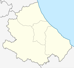
The Fucine Lake (Italian: Lago Fucino or Lago di Celano) was a large endorheic karst lake between 650 and 680 m (2,130 and 2,230 ft) above sea level and surrounded by the Monte Sirente-Monte Velino mountain ranges to the north-northeast, Mount Salviano to the west, Vallelonga to the south, and the Valle del Giovenco to the east-southeast. Located in western Abruzzo in central Italy, the town of Avezzano lies to the northwest, Ortucchio to the southeast, and Trasacco to the southwest of the historic lake. Once the third largest lake in Italy after Lake Garda and Lake Maggiore, it was finally drained in 1878.[1]
The plain is a geographical depression of tectonic origin formed during the Apennine orogeny between the Pliocene and Quaternary.[2]
To the west, Fucino borders the Palentini plains, while the Giovenco, Vallelonga, and Roveto valleys converge towards the Fucine plain. Due to the absence of outlets and the sudden variations in the water level causing floods or unhealthy drying, it was the subject of numerous attempts at regulation. The first partial draining of the endorheic basin[3] was carried out by the Roman emperor Claudius in 52 CE.
The total draining of the Fucian basin was undertaken in the second half of the 19th century by Jean François Mayor de Montricher, who expanded the hydraulic works of the Roman era by increasing the number of wells and expanding the vents and underground canals. These works and others drained Lake Fucino by 1878.
An improvement in socio-economic conditions followed its draining and the resultant plain is one of the most fertile vegetable growing areas in Italy. Products that have obtained European Protected geographical indication marks include the Fucino potato[4] and the Fucino plateau carrot.[5]
Along the former Fucino shoreline, in addition to Avezzano (the largest city), are other populous municipalities including Celano and Pescina.
In addition to agriculture, the plain also hosts the Fucino Space Centre. The teleport commenced construction in 1963 by the Telespazio company and is used for the ground management of artificial satellites in orbit for telecommunications.[6]

- ^ "Il prosciugamento del Fucino" (in Italian). Comune di Avezzano.
- ^ Cavinato, Gian Paolo; Carusi, Claudio; Dall'Asta, Massimo; Piacentini, Tommaso; Miccadei, Enrico (April 2002). "Sedimentary and tectonic evolution of Plio-Peistocene alluvial and lacustrine deposits of Fucino Basin (central Italy)". Retrieved 22 December 2023.
- ^ Bettina Reitz (8 May 2013). "Chapter II: The Emperor's New Nature: Debating the Draining of the Fucine Lake". Leiden University. Retrieved 22 December 2023.
- ^ "Qualigeo: Patata del Fucino PGI". Retrieved 22 December 2023.
- ^ "Qualigeo: Carota dell'Altopiano del Fucino IGP". Retrieved 22 December 2023.
- ^ "Telespazio: Our History". Retrieved 22 December 2023.
Previous Page Next Page


