Our website is made possible by displaying online advertisements to our visitors.
Please consider supporting us by disabling your ad blocker.
Gaztambide (Madrid)
Gaztambide | |
|---|---|
 | |
 | |
| Country | Spain |
| Autonomous community | Madrid |
| Municipality | Madrid |
| District | Chamberí |
| Area | |
• Total | 0.506596 km2 (0.195598 sq mi) |
| Population | 23,038 |
| • Density | 45,000/km2 (120,000/sq mi) |
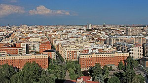
Gaztambide is an administrative neighborhood (barrio) of Madrid belonging to the district of Chamberí. It has an area of 0.506596 km2 (0.195598 sq mi).[1] As of 1 February 2021, it has a population of 23,038.[2]
Wikimedia Commons has media related to Gaztambide neighborhood, Madrid.
- ^ "Callejero vigente. Barrios". Ayuntamiento de Madrid. Retrieved 2 March 2021.
- ^ "Población por distrito y barrio". Ayuntamiento de Madrid. Retrieved 2 March 2021.
Previous Page Next Page


