Our website is made possible by displaying online advertisements to our visitors.
Please consider supporting us by disabling your ad blocker.
Gloucester Township, New Jersey
Gloucester Township, New Jersey | |
|---|---|
 | |
| Motto(s): "A great place to live, work and play." | |
 Location of Gloucester Township in Camden County highlighted in red | |
 Census Bureau map of Gloucester Township, New Jersey | |
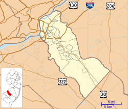
Location in Camden County Location in New Jersey | |
| Coordinates: 39°47′32″N 75°02′10″W / 39.792186°N 75.036059°W[1][2] | |
| Country | |
| State | |
| County | Camden |
| Formed | June 1, 1695 |
| Incorporated | February 21, 1798 |
| Named for | Gloucester, England |
| Government | |
| • Type | Faulkner Act (mayor–council) |
| • Body | Township Council |
| • Mayor | David R. Mayer (D, term ends December 31, 2025)[3][4] |
| • Administrator | Tom Cardis[5] |
| • Municipal clerk | Nancy Power[6] |
| Area | |
• Total | 23.30 sq mi (60.34 km2) |
| • Land | 22.95 sq mi (59.45 km2) |
| • Water | 0.34 sq mi (0.88 km2) 1.46% |
| • Rank | 119th of 565 in state 4th of 37 in county[1] |
| Elevation | 118 ft (36 m) |
| Population | |
• Total | 66,034 |
| 66,239 | |
| • Rank | 22nd of 565 in state 3rd of 37 in county[12] |
| • Density | 2,876.7/sq mi (1,110.7/km2) |
| • Rank | 226th of 565 in state 25th of 37 in county[12] |
| Time zone | UTC−05:00 (Eastern (EST)) |
| • Summer (DST) | UTC−04:00 (Eastern (EDT)) |
| ZIP Codes | |
| Area code | 856[14] |
| FIPS code | 3400726760[1][15][16] |
| GNIS feature ID | 0882154[17] |
| Website | www |
Gloucester Township is a township in Camden County in the U.S. state of New Jersey. As of the 2020 United States census, the township was the state's 22nd-most-populous municipality,[18] with a population was 66,034,[9][10] an increase of 1,400 (+2.2%) from the 2010 census count of 64,634,[19][20] which in turn reflected an increase of 284 (+0.4%) from the 64,350 counted in the 2000 census.[21] The township had been ranked as the 19th-most populous municipality in the state in 2010 after having been ranked 18th in 2000.[22]
Gloucester Township was formed on June 1, 1695, while the area was still part of Gloucester County. It was incorporated as one of New Jersey's first 104 townships by an act of the New Jersey Legislature on February 21, 1798. When Camden County was established on March 13, 1844, it was included in that county. Over time, pieces of the township were taken to create Winslow Township (March 8, 1845), Clementon Township (February 24, 1903; dissolved on May 16, 1941; became Laurel Springs), and Union Township (November 15, 1831; dissolved on February 25, 1868, with remaining land chartered as Gloucester City).[23] The township is part of South Jersey and constitutes part of the larger Philadelphia metropolitan area.
- ^ a b c d 2019 Census Gazetteer Files: New Jersey Places, United States Census Bureau. Accessed July 1, 2020.
- ^ US Gazetteer files: 2010, 2000, and 1990, United States Census Bureau. Accessed September 4, 2014.
- ^ Cite error: The named reference
Officialswas invoked but never defined (see the help page). - ^ 2023 New Jersey Mayors Directory, New Jersey Department of Community Affairs, updated February 8, 2023. Accessed February 10, 2023.
- ^ Departments Archived 2011-05-01 at the Wayback Machine, Gloucester Township. Accessed October 4, 2012.
- ^ Municipal Clerk, Gloucester Township. Accessed April 28, 2023.
- ^ Cite error: The named reference
DataBookwas invoked but never defined (see the help page). - ^ U.S. Geological Survey Geographic Names Information System: Township of Gloucester, Geographic Names Information System. Accessed March 5, 2013.
- ^ a b c Cite error: The named reference
Census2020was invoked but never defined (see the help page). - ^ a b Cite error: The named reference
LWD2020was invoked but never defined (see the help page). - ^ Cite error: The named reference
PopEstwas invoked but never defined (see the help page). - ^ a b Population Density by County and Municipality: New Jersey, 2020 and 2021, New Jersey Department of Labor and Workforce Development. Accessed March 1, 2023.
- ^ Camden County, NJ - New Jersey ZIP Codes
- ^ Area Code Lookup - NPA NXX for Blackwood, NJ, Area-Codes.com. Accessed October 14, 2013.
- ^ U.S. Census website, United States Census Bureau. Accessed September 4, 2014.
- ^ Geographic Codes Lookup for New Jersey, Missouri Census Data Center. Accessed April 1, 2022.
- ^ US Board on Geographic Names, United States Geological Survey. Accessed September 4, 2014.
- ^ Table1. New Jersey Counties and Most Populous Cities and Townships: 2020 and 2010 Censuses, New Jersey Department of Labor and Workforce Development. Accessed December 1, 2022.
- ^ Cite error: The named reference
Census2010was invoked but never defined (see the help page). - ^ Cite error: The named reference
LWD2010was invoked but never defined (see the help page). - ^ Table 7. Population for the Counties and Municipalities in New Jersey: 1990, 2000 and 2010, New Jersey Department of Labor and Workforce Development, February 2011. Accessed May 1, 2023.
- ^ The Counties and Most Populous Cities and Townships in 2010 in New Jersey: 2000 and 2010, New Jersey Department of Labor and Workforce Development. Accessed January 29, 2017.
- ^ Snyder, John P. The Story of New Jersey's Civil Boundaries: 1606-1968, Bureau of Geology and Topography; Trenton, New Jersey; 1969. p. 105. Accessed March 12, 2012.
Previous Page Next Page


