Our website is made possible by displaying online advertisements to our visitors.
Please consider supporting us by disabling your ad blocker.
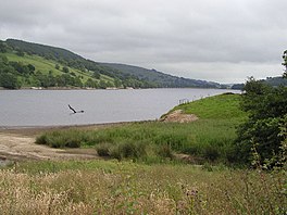
Gouthwaite Reservoir
| Gouthwaite Reservoir | |
|---|---|
 Gouthwaite Reservoir | |
| Location | England |
| Coordinates | 54°6′51″N 1°47′47″W / 54.11417°N 1.79639°W |
| Type | reservoir |
| Primary inflows | River Nidd |
| Primary outflows | River Nidd |
| Basin countries | United Kingdom |
| Surface area | 312 acres (126 ha)[1] |
| Shore length1 | 4.9 miles (7.9 km)[1] |
| Surface elevation | 433 feet (132 m)[1] |
| 1 Shore length is not a well-defined measure. | |
Gouthwaite Reservoir is in Nidderdale, North Yorkshire, England. It is one of many reservoirs in the area, others include Roundhill Reservoir and Angram Reservoir.
Gouthwaite is a compensation reservoir for the River Nidd, i.e. it maintains the downstream flow of the river during periods of high and low rainfall.[2][3]
- ^ a b c "Gouthwaite Reservoir, North Yorkshire – British Lakes". britishlakes.info. Archived from the original on 27 November 2018. Retrieved 27 November 2018.
- ^ "Yorkshire Water to start £7m scheme to improve safety at Gouthwaite reservoir". Water Briefing. 12 May 2017. Retrieved 27 November 2018.
- ^ Cudworth, W. (1896). Manningham, Heaton, and Allerton (townships of Bradford) treated historically and topographically. Рипол Классик. p. 232. ISBN 978-5-87547-985-4. Retrieved 29 April 2019.
Previous Page Next Page


