Our website is made possible by displaying online advertisements to our visitors.
Please consider supporting us by disabling your ad blocker.
Grafton, New South Wales
| Grafton New South Wales | |||||||||
|---|---|---|---|---|---|---|---|---|---|
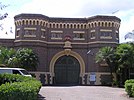
(From left to right) Grafton Bridge from North Bank Grafton Court House, Grafton Gaol Clarence River, Grafton Post Office Market Square, Christ Church Cathedral | |||||||||
 | |||||||||
| Coordinates | 29°41′0″S 152°56′0″E / 29.68333°S 152.93333°E | ||||||||
| Population | 19,255 (2021)[1] | ||||||||
| Established | 1851 | ||||||||
| Postcode(s) | 2460 | ||||||||
| Elevation | 5 m (16 ft) | ||||||||
| Location |
| ||||||||
| LGA(s) | Clarence Valley Council | ||||||||
| Region | Northern Rivers | ||||||||
| County | Clarence | ||||||||
| State electorate(s) | Clarence | ||||||||
| Federal division(s) | Page | ||||||||
| |||||||||
Grafton (Bundjalung-Yugambeh: Gumbin Gir)[2] is a city[3] in the Northern Rivers region of the Australian state of New South Wales. It is located on the Clarence River, on a floodplain, approximately 620 kilometres (385 mi) by road north-northeast of the state capital Sydney.
The closest major cities, Brisbane and the Gold Coast, are located across the border in South East Queensland. At the 2021 census, Grafton had a population of 19,255.[1] The city is the largest settlement and, with Maclean, the shared administrative centre of the Clarence Valley Council local government area, which is home to over 50,000 people in all.
- ^ a b Australian Bureau of Statistics (28 June 2022). "Grafton". 2021 Census QuickStats. Retrieved 16 October 2022.
- ^ "Search word: Grafton". Yugambeh-Bundjalung Dictionary.
- ^ "Grafton". Geographical Names Register (GNR) of NSW. Geographical Names Board of New South Wales. Retrieved 5 October 2021.
Previous Page Next Page


