Our website is made possible by displaying online advertisements to our visitors.
Please consider supporting us by disabling your ad blocker.
Greene County, Pennsylvania
This article needs additional citations for verification. (March 2022) |
39°52′N 80°13′W / 39.86°N 80.22°W
Greene County | |
|---|---|
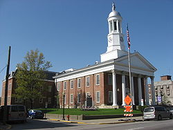
 Greene County Courthouse | |
 Location within the U.S. state of Pennsylvania | |
 Pennsylvania's location within the U.S. | |
| Coordinates: 39°52′N 80°13′W / 39.86°N 80.22°W | |
| Country | |
| State | |
| Founded | February 9, 1796 |
| Named for | Nathanael Greene |
| Seat | Waynesburg |
| Largest borough | Waynesburg |
| Government | |
| • Chairman of the Board of Commissioners | Jared Edgreen |
| Area | |
• Total | 578 sq mi (1,500 km2) |
| • Land | 576 sq mi (1,490 km2) |
| • Water | 2.0 sq mi (5 km2) 0.4% |
| Population (2020) | |
• Total | 35,954 |
| • Density | 62/sq mi (24/km2) |
| Time zone | UTC−5 (Eastern) |
| • Summer (DST) | UTC−4 (EDT) |
| Congressional district | 14th |
| Website | www.co.greene.pa.us |
Greene County is a county in the Commonwealth of Pennsylvania. As of the 2020 census, the population was 35,954.[1] Its county seat is Waynesburg.[2] Greene County was created on February 9, 1796, from part of Washington County and named for General Nathanael Greene. The county is part of the Southwest Pennsylvania region of the state.[a] Greene County is part of the Pittsburgh media market. It is in the area of southwestern Pennsylvania that was claimed by Virginia, the District of West Augusta.
- ^ "Census - Geography Profile: Greene County, Pennsylvania". United States Census Bureau. Retrieved December 18, 2022.
- ^ "Find a County". National Association of Counties. Archived from the original on May 31, 2011. Retrieved June 7, 2011.
Cite error: There are <ref group=lower-alpha> tags or {{efn}} templates on this page, but the references will not show without a {{reflist|group=lower-alpha}} template or {{notelist}} template (see the help page).
Previous Page Next Page
مقاطعة غرين (بنسيلفانيا) Arabic Greene County, Pennsylvania BAR Грийн (окръг, Пенсилвания) Bulgarian গ্রীনি কাউন্টি, পেনসিলভানিয়া BPY Greene Gông (Pennsylvania) CDO Greene County (kondado sa Tinipong Bansa, Pennsylvania) CEB Greene County, Pennsylvania CY Greene County (Pennsylvania) German Κομητεία Γκριν (Πενσυλβάνια) Greek Kantono Greene (Pensilvanio) EO


