Our website is made possible by displaying online advertisements to our visitors.
Please consider supporting us by disabling your ad blocker.
Hartville, Ohio
Hartville, Ohio | |
|---|---|
 Downtown Hartville in the spring | |
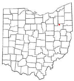
 Location of Hartville, Ohio | |
 Location of Hartville in Stark County | |
| Coordinates: 40°57′42″N 81°20′05″W / 40.96167°N 81.33472°W | |
| Country | United States |
| State | Ohio |
| County | Stark |
| Township | Lake |
| Area | |
• Total | 2.70 sq mi (6.99 km2) |
| • Land | 2.70 sq mi (6.99 km2) |
| • Water | 0.00 sq mi (0.00 km2) |
| Elevation | 1,161 ft (354 m) |
| Population (2020) | |
• Total | 3,329 |
• Estimate (2023)[3] | 3,385 |
| • Density | 1,233.88/sq mi (476.38/km2) |
| Time zone | UTC-5 (Eastern (EST)) |
| • Summer (DST) | UTC-4 (EDT) |
| ZIP code | 44632 |
| Area code | 330 |
| FIPS code | 39-34328[4] |
| GNIS feature ID | 2398260[2] |
| Website | www |
Hartville is a village in northern Stark County, Ohio, United States. The population was 3,329 at the 2020 census. It is part of the Canton–Massillon metropolitan area. Hartville lies halfway between Akron and Canton at the intersection of State Routes 43 and 619.
- ^ "ArcGIS REST Services Directory". United States Census Bureau. Retrieved September 20, 2022.
- ^ a b U.S. Geological Survey Geographic Names Information System: Hartville, Ohio
- ^ "Annual Estimates of the Resident Population for Incorporated Places in Ohio: April 1, 2020 to July 1, 2023". United States Census Bureau. Retrieved July 8, 2024.
- ^ "U.S. Census website". United States Census Bureau. Retrieved January 31, 2008.
Previous Page Next Page


