Our website is made possible by displaying online advertisements to our visitors.
Please consider supporting us by disabling your ad blocker.
Hertfordshire
Hertfordshire | |
|---|---|
 | |
| Coordinates: 51°49′N 0°13′W / 51.817°N 0.217°W | |
| Sovereign state | United Kingdom |
| Constituent country | England |
| Region | East |
| Established | Likely 10th century |
| Time zone | UTC+0 (GMT) |
| • Summer (DST) | UTC+1 (BST) |
| UK Parliament | List of MPs |
| Police | Hertfordshire Constabulary |
| Largest town | Watford |
| Ceremonial county | |
| Lord Lieutenant | Robert Voss |
| High Sheriff | Anne Patricia Brewster[1] (2024-25) |
| Area | 1,643 km2 (634 sq mi) |
| • Rank | 36th of 48 |
| Population (2022)[2] | 1,204,588 |
| • Rank | 13th of 48 |
| Density | 733/km2 (1,900/sq mi) |
| Non-metropolitan county | |
| County council | Hertfordshire County Council |
| Control | Conservative |
| Admin HQ | Hertford |
| Area | 1,643 km2 (634 sq mi) |
| • Rank | 21st of 21 |
| Population (2022)[3] | 1,204,588 |
| • Rank | 6th of 21 |
| Density | 733/km2 (1,900/sq mi) |
| ISO 3166-2 | GB-HRT |
| GSS code | E10000015 |
| ITL | UKH23 |
| Website | hertfordshire |
| Districts | |
 Districts of Hertfordshire | |
| Districts | |
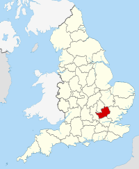
Hertfordshire (/ˈhɑːrtfərdʃɪər/ ⓘ HART-fərd-sheer or /-ʃər/ -shər; often abbreviated Herts) is a ceremonial county in the East of England and one of the home counties. It borders Bedfordshire to the north-west, Cambridgeshire to the north-east, Essex to the east, Greater London to the south and Buckinghamshire to the west. The largest settlement is Watford, and the county town is Hertford.
The county has an area of 634 square miles (1,640 km2) and had a population of 1,198,800 at the 2021 census.[4] After Watford (131,325), the largest settlements are Hemel Hempstead (95,985), Stevenage (94,470) and the city of St Albans (75,540).[5] For local government purposes Hertfordshire is a non-metropolitan county with ten districts beneath Hertfordshire County Council.
Elevations are higher in the north and west, reaching more than 800 feet (240 m) in the Chilterns near Tring. The county centres on the headwaters and upper valleys of the rivers Lea and the Colne; both flow south and each is accompanied by a canal. Hertfordshire's undeveloped land is mainly agricultural and much of the county is covered by the Metropolitan green belt.
Since 1903, Letchworth has served as the prototype garden city while Stevenage became the first town to expand under post-war Britain's New Towns Act 1946 (9 & 10 Geo. 6. c. 68). Services have become the largest sector of the county's economy.
- ^ "No. 64345". The London Gazette. 10 March 2023. p. 5286.
- ^ "Mid-2022 population estimates by Lieutenancy areas (as at 1997) for England and Wales". Office for National Statistics. 24 June 2024. Retrieved 26 June 2024.
- ^ "Mid-Year Population Estimates, UK, June 2022". Office for National Statistics. 26 March 2024. Retrieved 3 May 2024.
- ^ "Census 2021 Profile for Hertfordshire". Herts Insight. Retrieved 14 December 2023.
- ^ "Towns and cities, characteristics of built-up areas, England and Wales - Office for National Statistics". www.ons.gov.uk. Retrieved 14 December 2023.
Previous Page Next Page


