Our website is made possible by displaying online advertisements to our visitors.
Please consider supporting us by disabling your ad blocker.
Hiawatha National Forest
| Hiawatha National Forest | |
|---|---|
IUCN category VI (protected area with sustainable use of natural resources) | |
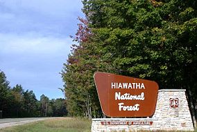
 Road sign of the Hiawatha National Forest in Alger County | |
| Location | Upper Peninsula of Michigan, United States |
| Nearest city | Escanaba, Michigan |
| Coordinates | 46°08′N 86°40′W / 46.133°N 86.667°W |
| Area | 894,836 acres (3,621.27 km2)[1] |
| Established | January 16, 1931[2] |
| Governing body | U.S. Forest Service |
| Website | Hiawatha National Forest |

Hiawatha National Forest is a 894,836-acre (362,127 ha) National Forest in the Upper Peninsula of the state of Michigan in the United States.[1] Commercial logging is conducted in some areas. The United States Forest Service administers this National Forest; it is physically divided into two subunits, commonly called the Eastside 46°14′N 84°50′W / 46.233°N 84.833°W and Westside 46°08′N 86°40′W / 46.133°N 86.667°W.
- ^ a b "Land Areas of the National Forest System" (PDF). U.S. Forest Service. January 2012. Retrieved June 20, 2012.
- ^ "The National Forests of the United States" (PDF). ForestHistory.org. Archived from the original (PDF) on October 28, 2012. Retrieved June 20, 2012.
Previous Page Next Page


