Our website is made possible by displaying online advertisements to our visitors.
Please consider supporting us by disabling your ad blocker.
Hiva Oa
Hiva'oa | |
|---|---|
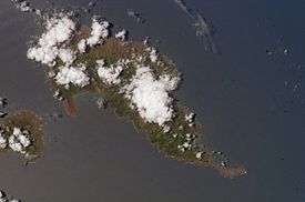
 The island of Hiva Oa. Atuouna is located on the large bay on the south side of the island. | |
 Location of Hiva Oa within the Marquesas Islands | |
| Geography | |
| Location | South Pacific Ocean |
| Coordinates | 9°45′S 139°00′W / 9.750°S 139.000°W |
| Archipelago | Marquesas Islands |
| Area | 316 km2 (122 sq mi) |
| Highest elevation | 1,213 m (3980 ft) |
| Highest point | Temetiu |
| Administration | |
| Overseas country | French Polynesia |
| Demographics | |
| Population | 2,190 (2012) |
| Pop. density | 6.9/km2 (17.9/sq mi) |
With its 320 square kilometres (124 square miles), Hiva Oa (Marquesan: Hivaʻoa)[1] is the second largest island in the Marquesas Islands, in French Polynesia, an overseas territory of France in the Pacific Ocean. Located at 9 45' south latitude and 139 W longitude, it is the largest island of the southern Marquesas group. Around 2,200 people reside on the island. A volcano, Temetiu, is Hiva Oa's highest point with 1,200 metres (3,937 feet).
Previous Page Next Page


