Our website is made possible by displaying online advertisements to our visitors.
Please consider supporting us by disabling your ad blocker.
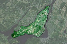
Island of Montreal
 Satellite image of the Island of Montreal | |
| Geography | |
|---|---|
| Location | Saint Lawrence River |
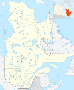
| Coordinates | 45°30′01″N 73°38′47″W / 45.50028°N 73.64639°W |
| Archipelago | Hochelaga Archipelago |
| Area | 472.55 km2 (182.45 sq mi) |
| Length | 50 km (31 mi) |
| Width | 16 km (9.9 mi) |
| Highest elevation | 233 m (764 ft) |
| Highest point | Mount Royal |
| Administration | |
Canada | |
| Province | Quebec |
| City | Montreal |
| Demographics | |
| Population | 2,004,265[citation needed] (2021) |
| Pop. density | 4,022.3/km2 (10417.7/sq mi) |
| Ethnic groups | Multiracial (over 200 ethnic groups) |
The Island of Montreal (French: Île de Montréal, [il d(ə) mɔ̃ʁeal]) is an island in southwestern Quebec, Canada,[1] which is the site of a number of municipalities, including most of the city of Montreal, and is the most populous island in Canada. It is the main island of the Hochelaga Archipelago at the confluence of the Saint Lawrence and Ottawa rivers.[2][3]
- ^ "Montréal Island".
- ^ nationsonline.org, klaus kästle. "Google Map of the City of Montréal – Nations Online Project". Nationsonline.org. Retrieved 21 December 2017.
- ^ [1] Archived 2008-10-21 at the Wayback Machine
Previous Page Next Page


