Our website is made possible by displaying online advertisements to our visitors.
Please consider supporting us by disabling your ad blocker.
Itapeva, Minas Gerais
Itapeva | |
|---|---|
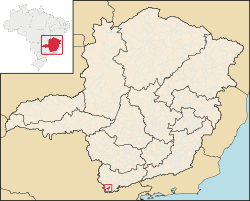
 Location in Minas Gerais state | |
| Coordinates: 22°46′4″S 46°13′15″W / 22.76778°S 46.22083°W | |
| Country | Brazil |
| Region | Southeast |
| State | Minas Gerais |
| Area | |
• Total | 177 km2 (68 sq mi) |
| Population (2020 [1]) | |
• Total | 9,881 |
| • Density | 56/km2 (140/sq mi) |
| Time zone | UTC−3 (BRT) |
Itapeva is a municipality in the state of Minas Gerais in Brazil. The population is 9,881 (2020 est.) in an area of 177 km².
The municipality contains part of the 180,373 hectares (445,710 acres) Fernão Dias Environmental Protection Area, created in 1997.[2]
- ^ IBGE 2020
- ^ APA Fernão Dias (in Portuguese), ISA: Instituto Socioambiental, retrieved 2016-10-02
Previous Page Next Page


