Our website is made possible by displaying online advertisements to our visitors.
Please consider supporting us by disabling your ad blocker.
Jai Valley
| Jai Valley | |
|---|---|
| Jai Top | |
 Jai Valley in summers | |
| Floor elevation | 7,800 ft (2,400 m)[1] |
| Length | 6 km (3.7 mi) [2] |
| Width | 0.5 km (0.31 mi) |
| Naming | |
| Native name | जाय घाटी (Jaie Ghati) (Hindi)[3] |
| English translation | Jaie Valley |
| Geography | |
| Country | India |
| State | |
| Region | Jammu |
| District | Doda |
| Coordinates | 33°01′41″N 75°46′22″E / 33.027984°N 75.772830°E |
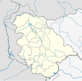
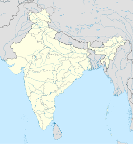
Jai Valley (/ʒæɪ ˈvæli/) is an enchanting valley[4][5] located 32 kilometres (20 miles) northeast of Bhaderwah town in Jammu and Kashmir, India. The Bhaderwah-Jai road, which passes through the corniferous deodar forests of Nakshri, Balote, Bhalara and Chinta Valley connects the valley with the Bhaderwah town.[6] The valley has green meadows[7] which act as the attraction for tourists in summers and the snow-covered landscape during winters.[8] Jai valley has about 9 kilometres (5.6 miles) long meadows, bisected by a stream called Jai Nallah which merges with a tributary of river Chenab at Kahara in tehsil Thathri.[5] It is also known by the names Jai Garh and Jai Top. The valley is also connected through a 37 kilometres (23 miles) long road with Gandoh.[9] There is no Mobile Network in this valley.
- ^ Qazi, S.A. (2005), Systematic Geography of Jammu and Kashmir, APH Publishing Corporation, p. 138, ISBN 81-7648-786-4
- ^ Cite error: The named reference
jammutourism.govwas invoked but never defined (see the help page). - ^ "Closure of roads affects winter tourism in Bhadarwah". State Times. 18 Feb 2018. Retrieved 24 Jun 2020.
- ^ Chowdhary, Charu (20 Jun 2019). "Bhaderwah: What to Experience in J&K's Mini Kashmir". India.com. Retrieved 24 Jun 2020.
- ^ a b "Jai Valley". District Administration Doda. 2 Jun 2020. Retrieved 23 Jun 2020.
- ^ "Jai Valley, an eco-health resort in Bhaderwah". JK Report. 21 October 2015. Retrieved 24 Jun 2020.
- ^ Cite error: The named reference
tribunewas invoked but never defined (see the help page). - ^ "Bhadarwah meadows covered in white blanket". State Times. 19 Nov 2017. Retrieved 25 Jun 2020.
- ^ Cite error: The named reference
ex-newswas invoked but never defined (see the help page).
Previous Page Next Page


