Our website is made possible by displaying online advertisements to our visitors.
Please consider supporting us by disabling your ad blocker.
Juniper Green
| Juniper Green | |
|---|---|
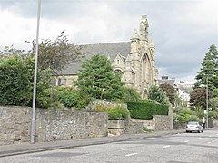
 The parish church | |
Location within the City of Edinburgh council area Location within Scotland | |
| OS grid reference | NT195685 |
| Council area | |
| Country | Scotland |
| Sovereign state | United Kingdom |
| Post town | JUNIPER GREEN |
| Postcode district | EH14 |
| Dialling code | 0131 |
| Police | Scotland |
| Fire | Scottish |
| Ambulance | Scottish |
| UK Parliament | |
| Scottish Parliament | |
Juniper Green is a village on the outskirts of Edinburgh, Scotland, situated about 5.5 miles (8.9 km) south-west of the city centre. It bridges the city bypass, and extends along the foothills of the Pentlands. It is bordered by Colinton to the east, Baberton immediately to the north, and Currie to the south-west. It centres on Lanark Road, the main route leading out south-west of Edinburgh into the Central Borders. The village stands on an elevated ridge above the Water of Leith to its south.
Administratively, Juniper Green falls within the jurisdiction of the City of Edinburgh Council having been officially absorbed into the city in 1920.
Previous Page Next Page


