Our website is made possible by displaying online advertisements to our visitors.
Please consider supporting us by disabling your ad blocker.
Kayan River
| Kayan River Sungai Kayan, Sungai Bulungan, Sungai Kajan, Sungai Ulungan, Boetoengan Rivier, Bulungan River, Boeloengan Rivier | |
|---|---|
 Panoramic Kayan River | |
| Location | |
| Country | Indonesia |
| Physical characteristics | |
| Source | |
| • location | Borneo |
| • elevation | 2,015 metres (6,611 ft) |
| Mouth | |
• location | Sulawesi Sea |
• coordinates | 2°54′41.29″N 117°33′14.11″E / 2.9114694°N 117.5539194°E |
| Length | 576 kilometres (358 mi) |
| Basin size | 33,005 km2 (12,743 sq mi) 33,171.8 km2 (12,807.7 sq mi) |
| Discharge | |
| • location | Kayan III Hydropower Station, 72 km upstream of Tanjung Selor (basin size 26,260 km2 (10,140 sq mi)[1] |
| • average | 2,184 m3/s (77,100 cu ft/s)[1] |
| Discharge | |
| • location | Tanjung Selor |
| • average | 2,454 m3/s (86,700 cu ft/s)[1] (Period of data: 2016–2020)2,261 m3/s (79,800 cu ft/s)[2] |
| Discharge | |
| • location | Kayan Delta, Sulawesi Sea |
| • average | 77.738 km3/a (2,463.4 m3/s) |
| Basin features | |
| River system | Kayan basin (DAS320024)[3] |
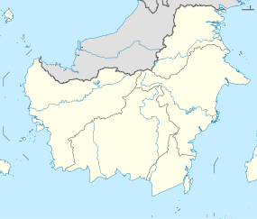
Kayan River in Kalimantan
The Kayan River is a river of Borneo island, flowing in the North Kalimantan province of Indonesia, about 1,600 km northeast of the capital Jakarta.[4][5] Tributaries include the Bahau River.
- ^ a b c Hanergy Holding Group (March 2013). Indonesia East Kalimantan Kayan River Basin Hydropower and Aluminum smelting Project (Slide deck). Archived from the original on 24 September 2021. Retrieved 24 September 2021 – via Scribd.
- ^ Delphine, Dobler; Elodie, Martinez; Rinny, Rahmania; Budhi Gunadharma, Gautama; A. Riza, Farhan (2021). Floating Marine Debris Along Indonesian Coasts: An Atlas of Strandings Based on Lagrangian Modelling (PDF). Archived (PDF) from the original on 7 January 2022. Retrieved 7 January 2022.
- ^ Hukum Online. "Keputusan Menteri Kehutanan No. SK.511/MENHUT-V/2011" (in Indonesian).
- ^ McNally, Rand (1993). The New International Atlas.
- ^ "Sungai Bulungan". GeoNames. Retrieved 29 June 2022.
Previous Page Next Page


