Our website is made possible by displaying online advertisements to our visitors.
Please consider supporting us by disabling your ad blocker.
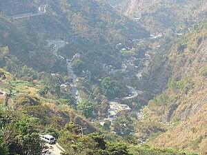
Kennon Road
| Kennon Road | |
|---|---|
| Benguet Road Rosario–Baguio Road | |
 Kennon Road as viewed from the Kennon Road Viewdeck | |
| Route information | |
| Maintained by Department of Public Works and Highways La Union 2nd District Engineering Office Benguet 1st District Engineering Office Baguio City District Engineering Office | |
| Length | 33.534 km (20.837 mi) |
| Existed | 1905–present |
| Component highways | |
| Restrictions | |
| Major junctions | |
| North end | |
| |
| South end | |
| Location | |
| Country | Philippines |
| Provinces | Benguet, La Union |
| Major cities | Baguio |
| Towns | Rosario, Pugo, Tuba |
| Highway system | |
| |
Kennon Road, also known as the Rosario–Baguio Road, is a two lane 33.53-kilometer (20.83 mi) roadway in Benguet province in the Philippines connecting the mountain city of Baguio in Benguet to the lowland town of Rosario in La Union province. Originally called Benguet Road,[1] it was later renamed in honor of its builder, Col. Lyman Walter Vere Kennon of the U.S. Army Corps of Engineers.
The construction began in 1903 and opened for travel on January 29, 1905. It is the second oldest road that leads to Baguio, after Quirino Highway, and the shortest route to Baguio for travelers from Manila and provinces in central and southern Luzon.[2]
The entire road forms part of National Route 54 (N54) of the Philippine highway network.
- ^ Cite error: The named reference
Midlandwas invoked but never defined (see the help page). - ^ Bankoff, Greg. (2005). These brothers of ours: Poblete's obreros and the road to Baguio 1903–1905. Journal of Social History - Volume 38, Number 4, Summer 2005, pp. 1047-1072 PDF at University of Auckland
Previous Page Next Page


