Our website is made possible by displaying online advertisements to our visitors.
Please consider supporting us by disabling your ad blocker.
Khao Khiao Massif
| Khao Khiao Massif | |
|---|---|
| เขาเขียว | |
 The Khao Khiao Massif rising east of Chonburi town | |
| Highest point | |
| Peak | Khao Khiao |
| Elevation | 789 m (2,589 ft) |
| Coordinates | 13°14′45″N 101°4′15″E / 13.24583°N 101.07083°E |
| Dimensions | |
| Length | 20 km (12 mi) N/S |
| Width | 10 km (6.2 mi) E/W |
| Geography | |
| Country | Thailand |
| Region | Chonburi Province |
| Range coordinates | 13°14.5′N 101°4′E / 13.2417°N 101.067°E |
| Geology | |
| Rock type(s) | Sandstone, conglomerate |
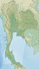
The Khao Khiao Massif (Thai: เขาเขียว, pronounced [kʰǎw kʰǐa̯w]) is a moderately high mountain range near Chonburi, eastern Thailand.[1] This massif has the last substantial forested zone in Chonburi Province, a region that is much affected by urbanization and other forms of human intervention and land degradation.
Khao Khiao is the mountain area closest to Bangkok, rising about 70 km to the southeast of the capital.
Previous Page Next Page


