Our website is made possible by displaying online advertisements to our visitors.
Please consider supporting us by disabling your ad blocker.
Khun Tan Range
| Khun Tan Range | |
|---|---|
| ทิวเขาขุนตาน | |
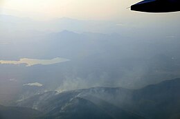
 View of the Khun Tan Range in Mae Lao District | |
| Highest point | |
| Peak | Doi Mae Tho |
| Elevation | 2,031 m (6,663 ft) |
| Coordinates | 19°05′00″N 99°20′30″E / 19.08333°N 99.34167°E |
| Dimensions | |
| Length | 260 km (160 mi) N/S |
| Width | 50 km (31 mi) E/W |
| Geography | |
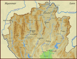
 Map of the Thai highlands | |
| Country | Thailand |
| Provinces | Chiang Mai, Chiang Rai, Lampang and Lamphun |
| Parent range | Phi Pan Nam Range |
| Geology | |
| Rock age | Triassic |
| Rock type(s) | granite, phyllite, shale and limestone |


The Khun Tan Range (Thai: ทิวเขาขุนตาน or, erroneously, ทิวเขาขุนตาล[1]) is a mountain range that occupies a central position in Northern Thailand. Most of the range is located in Chiang Mai, western Chiang Rai, Lampang and Lamphun Provinces.[2]
The geological composition of the Khun Tan mountains is different from the neighboring Thanon Thong Chai Range in the west and the Daen Lao Range in the north. Precambrian rocks are absent in this mountain chain which is thus not part of the Shan Hills system.[3] The geology of the Khun Tan Range is homogeneous with the Phi Pan Nam Range further east[4] and some scholarly works designate the Khun Tan as the "Western Phi Pan Nam Range", including it as part of the Phi Pan Nam Mountain System.[5]
- ^ ผศ.นงรัตน์ พยัคฆันตร. ภูมิศาสตร์การท่องเที่ยวไทย. มหาวิทยาลัยราชภัฏสวนดุสิต พ.ศ. 2528 (ปรับปรุง พ.ศ. 2549)
- ^ Northern Thailand Archived 2012-01-28 at the Wayback Machine
- ^ "Geology of Thailand - Ministry of Natural Resources and Environment, Bangkok". Archived from the original on 2017-12-01. Retrieved 2012-01-20.
- ^ ทิวเขาผีปันน้ำ Archived 2012-03-10 at the Wayback Machine (in Thai)
- ^ "Sarasawadee Ongsakul, The History of Lanna". Archived from the original on 2008-12-07. Retrieved 2012-02-27.
Previous Page Next Page


