Our website is made possible by displaying online advertisements to our visitors.
Please consider supporting us by disabling your ad blocker.
Kolomyia
Kolomyia
Коломия | |
|---|---|
| |
|
| |
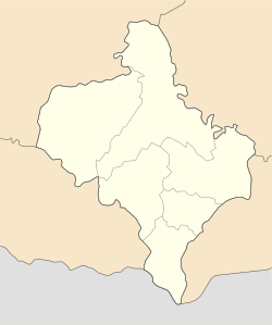
| Coordinates: 48°31′50″N 25°02′25″E / 48.53056°N 25.04028°E | |
| Country | |
| Oblast | Ivano-Frankivsk Oblast |
| Raion | Kolomyia Raion |
| Hromada | Kolomyia urban hromada |
| Area | |
• Total | 41 km2 (16 sq mi) |
| Population (2022) | |
• Total | 60,821 |
| • Density | 1,494/km2 (3,870/sq mi) |
| Website | www.ko.if.ua City's administrative statistics at Verkhovna Rada web-site[permanent dead link] |
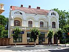
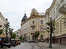
Kolomyia (Ukrainian: Коломия, IPA: [koloˈmɪjɐ] ⓘ), formerly known as Kolomea, is a city located on the Prut River in Ivano-Frankivsk Oblast in western Ukraine. It serves as the administrative centre of Kolomyia Raion, hosting the administration of Kolomyia urban hromada.[1] The population is 60,821 (2022 estimate).[2]
The city rests approximately halfway between Ivano-Frankivsk and Chernivtsi, in the centre of the historical region of Pokuttia, with which it shares much of its history. Kolomyia is a notable railroad hub, as well as an industrial centre (textiles, shoes, metallurgical plant, machine works, wood and paper industry). It is a centre of Hutsul culture. Until 1925 the town was the most populous town in the region. Before the Holocaust about half the town’s population was Jewish.
- ^ "Коломыйская городская громада" (in Russian). Портал об'єднаних громад України.
- ^ Чисельність наявного населення України на 1 січня 2022 [Number of Present Population of Ukraine, as of January 1, 2022] (PDF) (in Ukrainian and English). Kyiv: State Statistics Service of Ukraine. Archived (PDF) from the original on 4 July 2022.
Previous Page Next Page


