Our website is made possible by displaying online advertisements to our visitors.
Please consider supporting us by disabling your ad blocker.
Kotor
Kotor
Котор Cattaro | |
|---|---|
Town and municipality | |
|
| |
| Coordinates: 42°25′48″N 18°46′12″E / 42.43000°N 18.77000°E | |
| Country | Montenegro |
| Region | Coastal |
| Municipality | Kotor |
| Founded | 5th century BC |
| Government | |
| • Type | Mayor-Assembly |
| • Mayor | Vladimir Jokić (DCG) |
| Area | |
| • Municipality | 335 km2 (129 sq mi) |
| Population (2023) | |
| • Urban | 13,347 |
| • Rural | 8,569 |
| • Municipality | 21,916 |
| Time zone | UTC+1 (CET) |
| • Summer (DST) | UTC+2 (CEST) |
| Postal code | 85330 |
| Area code | +382 32 |
| Vehicle registration | KO |
| Patron saint | Saint Tryphon |
| Website | www |
| Part of | Natural and Culturo-Historical Region of Kotor |
| Criteria | Cultural: (i)(ii)(iii)(iv) |
| Reference | 125ter |
| Inscription | 1979 (3rd Session) |
| Extensions | 2012, 2015 |
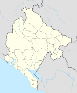
Kotor (Montenegrin Cyrillic: Котор, pronounced [kɔ̌tɔr]), historically known as Cattaro[1] (from Italian: pronounced [ˈkattaro]), is a town in Coastal region of Montenegro. It is located in a secluded part of the Bay of Kotor. The city has a population of 13,347 and is the administrative center of Kotor Municipality.
The old Mediterranean port of Kotor is surrounded by fortifications built during the Venetian period. It is located on the Bay of Kotor (Boka Kotorska), one of the most indented parts of the Adriatic Sea. Some have called it the southernmost fjord in Europe, but it is a ria, a submerged river canyon. Together with the nearly overhanging limestone cliffs of Orjen and Lovćen, Kotor and its surrounding area form an impressive landscape.
Since the early 2000s Kotor has seen an increase in tourists,[2] many of them coming by cruise ship. Visitors are attracted to the natural environment of the Bay of Kotor and the old town of Kotor. Kotor is part of the World Heritage Site dubbed the Natural and Culturo-Historical Region of Kotor.
The fortified city of Kotor was also included in UNESCO's World Heritage Site list as part of Venetian Works of Defence between 16th and 17th centuries: Stato da Terra – western Stato da Mar in 2017.[3]
- ^ Sketches from the Subject and Neighbour Lands of Venice. Macmillan and Company. 1881. p. 277.
- ^ World Travel and Tourism Council
- ^ Centre, UNESCO World Heritage. "Venetian Works of Defence between 16th and 17th centuries: Stato da Terra – western Stato da Mar". whc.unesco.org. Retrieved 11 July 2017.
Previous Page Next Page


