Our website is made possible by displaying online advertisements to our visitors.
Please consider supporting us by disabling your ad blocker.
Kut
You can help expand this article with text translated from the corresponding article in Arabic. Click [show] for important translation instructions.
|
Kut
ٱلْكُوت | |
|---|---|
| Coordinates: 32°30′20″N 45°49′29″E / 32.50556°N 45.82472°E | |
| Country | |
| Governorate | Wasit |
| Elevation | 23 m (75 ft) |
| Population (2019)[1] | |
• Total | 315,162 |
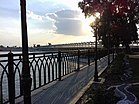
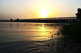
Kūt (Arabic: ٱلْكُوت, romanized: al-Kūt), officially Al-Kut, also spelled Kutulamare, Kut al-Imara, or Kut Al Amara is a city in eastern Iraq, on the left bank of the Tigris River, about 160 kilometres (99 miles) south east of Baghdad. As of 2018[update] the estimated population is about 389,400 people. It is the capital of the province long known as Al Kut, but since the 1960s renamed Wasit.
The old town of Kut is within a sharp "U" bend of the river, opposite from the point where the Shatt al-Gharraf branches off from the Tigris.[2] This U-shaped bend almost makes it an island but for a narrow connection to the shore. Kut was a regional center of the carpet trade for centuries. The area around Kut is a fertile cereal grain growing region. The Baghdad Nuclear Research Facility, looted following the 2003 US invasion of Iraq, is located near Kut.
- ^ "Geonames". geonames.org. Retrieved 30 September 2019.
- ^ Naval Intelligence Division guidebook (1944), p. 543
Previous Page Next Page


