Our website is made possible by displaying online advertisements to our visitors.
Please consider supporting us by disabling your ad blocker.
Laclede County, Missouri
Laclede County | |
|---|---|
 Laclede County Courthouse in Lebanon | |
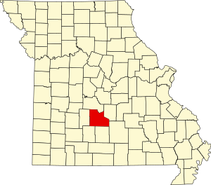
 Location within the U.S. state of Missouri | |
 Missouri's location within the U.S. | |
| Coordinates: 37°40′N 92°35′W / 37.66°N 92.59°W | |
| Country | |
| State | |
| Founded | February 24, 1849 |
| Named for | Pierre Laclede |
| Seat | Lebanon |
| Largest city | Lebanon |
| Area | |
• Total | 768 sq mi (1,990 km2) |
| • Land | 765 sq mi (1,980 km2) |
| • Water | 3.3 sq mi (9 km2) 0.4% |
| Population (2020) | |
• Total | 36,039 |
| • Density | 47/sq mi (18/km2) |
| Time zone | UTC−6 (Central) |
| • Summer (DST) | UTC−5 (CDT) |
| Congressional district | 4th |
| Website | lacledecountymissouri |
Laclede County is a county located in the U.S. state of Missouri. As of the 2020 census, the population was 36,039.[1] Its county seat is Lebanon.[2] The county was organized February 24, 1849, and was named after Pierre Laclède, founder of St. Louis.[3]
Laclede County comprises the Lebanon, MO Micropolitan Statistical Area.
- ^ "Laclede County, Missouri". United States Census Bureau. Retrieved June 13, 2023.
- ^ "Find a County". National Association of Counties. Retrieved June 7, 2011.
- ^ Eaton, David Wolfe (1916). How Missouri Counties, Towns and Streams Were Named. The State Historical Society of Missouri. pp. 182.
Previous Page Next Page


