Our website is made possible by displaying online advertisements to our visitors.
Please consider supporting us by disabling your ad blocker.
Lake Clifton, Western Australia
| Lake Clifton Western Australia | |||||||||||||||
|---|---|---|---|---|---|---|---|---|---|---|---|---|---|---|---|
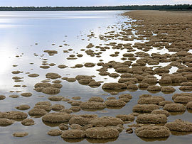
 Lake Clifton thrombolites | |||||||||||||||
 | |||||||||||||||
| Coordinates | 32°48′40″S 115°41′13″E / 32.811°S 115.687°E | ||||||||||||||
| Population | 759 (SAL 2021)[1] | ||||||||||||||
| Established | 1920 | ||||||||||||||
| Postcode(s) | 6215 | ||||||||||||||
| Area | 79.5 km2 (30.7 sq mi) | ||||||||||||||
| Location | |||||||||||||||
| LGA(s) | Shire of Waroona | ||||||||||||||
| State electorate(s) | Murray-Wellington | ||||||||||||||
| Federal division(s) | Canning | ||||||||||||||
| |||||||||||||||
Lake Clifton is a small town located on the east side of the lake of the same name in the Peel region of Western Australia just off the Old Coast Road, between Mandurah and Bunbury at the north end of the Yalgorup National Park. At the 2021 census, Lake Clifton had a population of 759.[2]
- ^ Australian Bureau of Statistics (28 June 2022). "Lake Clifton (suburb and locality)". Australian Census 2021 QuickStats. Retrieved 28 June 2022.
- ^ "2016 Census QuickStats: Lake Clifton". quickstats.censusdata.abs.gov.au. Retrieved 2 June 2019.
Previous Page Next Page


