Our website is made possible by displaying online advertisements to our visitors.
Please consider supporting us by disabling your ad blocker.
Leidschendam
Leidschendam | |
|---|---|
 Town center on a winter evening | |
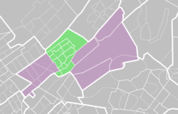
 Location in Leidschendam-Voorburg | |
 Location of Leidschendam-Voorburg in South Holland | |
| Coordinates: 52°5′N 4°24′E / 52.083°N 4.400°E | |
| Country | |
| Province | |
| Municipality | |
| Area | |
• Total | 8.44 km2 (3.26 sq mi) |
| • Land | 8.22 km2 (3.17 sq mi) |
| • Water | 0.23 km2 (0.09 sq mi) |
| Elevation | 0 m (0 ft) |
| Population (2012)[1] | |
• Total | 32,480 |
| • Density | 3,951/km2 (10,230/sq mi) |
| Demonym | Leidschendammer |
| Time zone | UTC+1 (CET) |
| • Summer (DST) | UTC+2 (CEST) |
| Postcode | 2260–2268 |
| Area code | 070 |
Leidschendam (Dutch pronunciation: [ˈlɛitsə(n)ˌdɑm]) is a town and former municipality in the province of South Holland of the Netherlands. Along with Voorburg and Stompwijk, it is part of the municipality Leidschendam-Voorburg.
- ^ a b "Kerncijfers wijken en buurten" [Key figures for neighbourhoods]. CBS Statline (in Dutch). CBS. 31 July 2013. Retrieved 11 August 2013.
- ^ "Postcodetool for 2264BM". Actueel Hoogtebestand Nederland (in Dutch). Het Waterschapshuis. Archived from the original on 21 September 2013. Retrieved 10 August 2013.
Previous Page Next Page


