Our website is made possible by displaying online advertisements to our visitors.
Please consider supporting us by disabling your ad blocker.
Lopau
| Lopau | |
|---|---|
 | |
 | |
| Location | |
| Country | Germany |
| State | Lower Saxony |
| Physical characteristics | |
| Source | |
| • location | source streams in the parish of Lopau |
| • coordinates | 53°03′23″N 10°12′16″E / 53.0563194°N 10.204306°E |
| • elevation | 70 m above sea level (NN) |
| Mouth | |
• location | near Oldendorf into the Luhe |
• coordinates | 53°08′43″N 10°12′55″E / 53.14528°N 10.21528°E |
• elevation | 37 m above sea level (NN) |
| Length | 12.8 km (8.0 mi) [1] |
| Basin size | 101 km2 (39 sq mi) [1] |
| Basin features | |
| Progression | Luhe→ Ilmenau→ Elbe→ North Sea |
| Landmarks |
|
| Tributaries | |
| • left | Ehlbeck |
| Waterbodies | Lakes: Lopausee |
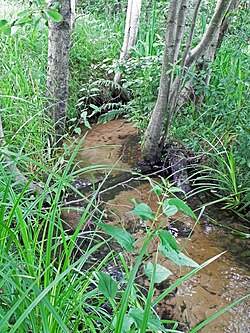
The Lopau is a river in the Lüneburg Heath in North Germany. It is a right tributary of the Luhe.
Previous Page Next Page


