Our website is made possible by displaying online advertisements to our visitors.
Please consider supporting us by disabling your ad blocker.
Los Mochis International Airport
Los Mochis International Airport Aeropuerto Internacional de Los Mochis | |||||||||||
|---|---|---|---|---|---|---|---|---|---|---|---|
 | |||||||||||
| Summary | |||||||||||
| Airport type | Public | ||||||||||
| Operator | Grupo Aeroportuario del Pacífico | ||||||||||
| Serves | Los Mochis, Sinaloa, Mexico | ||||||||||
| Time zone | MST (UTC-07:00) | ||||||||||
| Elevation AMSL | 5 m / 16 ft | ||||||||||
| Coordinates | 25°41′06″N 109°04′50″W / 25.68500°N 109.08056°W | ||||||||||
| Website | www | ||||||||||
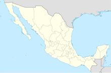
| Map | |||||||||||
 | |||||||||||
| Runways | |||||||||||
| |||||||||||
| Statistics (2024) | |||||||||||
| |||||||||||
Source: Grupo Aeroportuario del Pacífico[1] | |||||||||||
Los Mochis International Airport, (Spanish: Aeropuerto Internacional de Los Mochis); officially Aeropuerto Internacional Federal del Valle del Fuerte (Valle del Fuerte Federal International Airport) (IATA: LMM, ICAO: MMLM) is an international airport serving Los Mochis, Sinaloa, Mexico. The airport provides nonstop flights to various cities in Mexico and serves as a gateway in a heavily traveled air corridor connecting mainland Mexico to the Baja California peninsula. Additionally, it supports tourism, flight training, and general aviation activities. The airport is owned and operated by Grupo Aeroportuario del Pacífico.[2] In 2023, it handled 470,700 passengers, and this number increased to 585,200 passengers in 2024.[1]


- ^ a b "GAP Traffic Report 2024" (PDF). Grupo Aeroportuario del Pacífico. January 2025. Retrieved January 28, 2025.
- ^ "Grupo Aeroportuario del Pacifico".
Previous Page Next Page
Los Mochis International Airport CEB Flughafen Los Mochis German Aeropuerto Internacional Federal del Valle del Fuerte Spanish فرودگاه بینالمللی فورت ولی FA Aéroport international de Los Mochis French Bandar Udara Internasional Federal del Valle del Fuerte ID LMM Korean Lapangan Terbang Antarabangsa Valle Del Fuerte Malay Aeroportul Internațional Valle del Fuerte Federal Romanian Лос-Мочис (аэропорт) Russian


