Our website is made possible by displaying online advertisements to our visitors.
Please consider supporting us by disabling your ad blocker.
Loughtee Upper
Loughtee Upper
Lucht Tí Uachtarach (Irish) | |
|---|---|
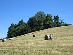
 Hayfield near Cavan Town | |
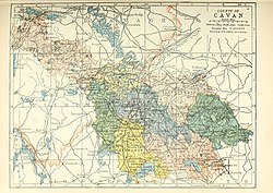
 Barony map of County Cavan, 1900; Loughtee Upper is in the centre, coloured blue. | |
| Coordinates: 54°0′N 7°18′W / 54.000°N 7.300°W | |
| Sovereign state | Ireland |
| Province | Ulster |
| County | Cavan |
| Area | |
• Total | 258.36 km2 (99.75 sq mi) |
Loughtee Upper (Irish: Lucht Tí Uachtarach), or Upper Loughtee, is a barony in County Cavan, Ireland.[1][2] Baronies were mainly cadastral rather than administrative units. They acquired modest local taxation and spending functions in the 19th century before being superseded by the Local Government (Ireland) Act 1898.[3]
- ^ Riain, Pádraig Ó (7 March 1985). Corpus genealogiarum sanctorum Hiberniae. Dublin Institute for Advanced Studies. ISBN 9780901282804 – via Google Books.
- ^ "DENN, a parish - Topographical Dictionary of Ireland (1837)". www.libraryireland.com.
- ^ General Register Office of Ireland (1904). "Alphabetical index to the baronies of Ireland". Census of Ireland 1901: General topographical index. Command papers. Vol. Cd. 2071. HMSO. pp. 966–978.
Previous Page Next Page


