Our website is made possible by displaying online advertisements to our visitors.
Please consider supporting us by disabling your ad blocker.
Lower Merion Township, Pennsylvania
Lower Merion
Lower Merion Township | |
|---|---|
 The Lower Merion Township building in Ardmore in April 2022 | |
| Motto: "A First-Class Township" | |
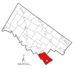
 Location of Lower Merion Township in Montgomery County, Pennsylvania | |
Location of Lower Merion Township in Pennsylvania | |
| Coordinates: 39°59′00″N 75°15′59″W / 39.98333°N 75.26639°W | |
| Country | |
| State | |
| County | Montgomery |
| Settled | 1682 |
| Incorporated | 1713 |
| Government | |
| • Township Manager | Ernie McNeely |
| • Board President | Todd Sinai (D) |
| Area | |
• Total | 23.83 sq mi (61.73 km2) |
| • Land | 23.61 sq mi (61.16 km2) |
| • Water | 0.22 sq mi (0.57 km2) |
| Elevation | 200 ft (60 m) |
| Population (2020) | |
• Total | 63,633 |
• Estimate (2021)[2] | 64,148 |
| • Density | 2,695/sq mi (1,040/km2) |
| Time zone | UTC-5 (EST) |
| • Summer (DST) | UTC-4 (EDT) |
| Area code | 610 and 484 |
| FIPS code | 42-091-44976 |
| Website | www |
Lower Merion Township is a township in Montgomery County, Pennsylvania, United States. It is part of the Philadelphia Main Line. The township's name originates with the county of Merioneth in north Wales. Merioneth is an English-language transcription of the Welsh Meirionnydd.
A number of Main Line suburbs are located in Lower Merion, west of Philadelphia, the sixth largest city in the United States as of 2020. With a population of 63,633, Lower Merion Township is the ninth-most populous municipality in Pennsylvania as of the 2020 U.S. census.[3]
The center of Lower Merion Township is located 11.9 miles (19.2 km) northwest of central Philadelphia, Pennsylvania's largest city-county, and parts of Lower Merion border this section of the city.
- ^ "2016 U.S. Gazetteer Files". United States Census Bureau. Retrieved August 14, 2017.
- ^ "Population and Housing Unit Estimates". Retrieved June 27, 2022.
- ^ "U.S. Census Bureau QuickFacts: Lower Merion township, Montgomery County, Pennsylvania". www.census.gov. Retrieved June 10, 2022.
Previous Page Next Page
Lower Merion Township, Pennsylvania CY Municipio de Lower Merion Spanish Lower Merion Township Finnish Lower Merion Township French ローワー・メリオン郡区 (ペンシルベニア州モンゴメリー郡) Japanese Lower Merion Township, Pennsylvania SIMPLE Ловер-Меріон Тауншип (Пенсільванія) Ukrainian لوئر میرین ٹاؤن شپ، پنسلوانیا UR Xã Lower Merion, Quận Montgomery, Pennsylvania VI


