Our website is made possible by displaying online advertisements to our visitors.
Please consider supporting us by disabling your ad blocker.
Lowndes County, Georgia
Lowndes County | |
|---|---|
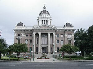
 Lowndes County Courthouse in Valdosta | |
 Location within the U.S. state of Georgia | |
 Georgia's location within the U.S. | |
| Coordinates: 30°50′N 83°16′W / 30.83°N 83.27°W | |
| Country | |
| State | |
| Founded | December 23, 1825 |
| Named for | William Jones Lowndes |
| Seat | Valdosta |
| Largest city | Valdosta |
| Area | |
• Total | 511 sq mi (1,320 km2) |
| • Land | 496 sq mi (1,280 km2) |
| • Water | 15 sq mi (40 km2) 2.8% |
| Population | |
• Estimate (2022) | 120,055 |
| • Density | 220/sq mi (80/km2) |
| Time zone | UTC−5 (Eastern) |
| • Summer (DST) | UTC−4 (EDT) |
| Congressional districts | 1st, 8th |
| Website | lowndescounty.com |
Lowndes County (/ˈlaʊndz/) is a county located in the south-central portion of the U.S. state of Georgia. As of the 2020 census, the population was 118,251.[1] The county seat is Valdosta.[2] The county was created December 23, 1825.
Lowndes County is included in the Valdosta metropolitan statistical area. It is located along the border with Florida.
The county is a major commercial, educational, and manufacturing center of south Georgia with considerable forest products including pulpwood and naval stores, such as turpentine and rosin. Part of Grand Bay, a 13,000-acre (53 km2) wetlands, is located in Lowndes County.
- ^ "Explore Census Data - Decennial Census P1 RACE 2020: DEC Redistricting Data (PL 94-171)". data.census.gov. United States Census Bureau. Archived from the original on November 2, 2022. Retrieved November 4, 2022.
- ^ "Find a County". National Association of Counties. Retrieved June 7, 2011.
Previous Page Next Page
مقاطعة لاونديز (جورجيا) Arabic لووندز بؤلگهسی، جورجیا AZB Lowndes County, Georgia BAR Лаундс (окръг, Джорджия) Bulgarian লৱনডেস কাউন্টি, জর্জিয়া BPY Lowndes Gông (Georgia) CDO Лоундес (гуо, Джорджи) CE Lowndes County (kondado sa Tinipong Bansa, Georgia) CEB Lowndes County, Georgia CY Lowndes County (Georgia) German


