Our website is made possible by displaying online advertisements to our visitors.
Please consider supporting us by disabling your ad blocker.
Maine
Maine | |
|---|---|
| Nicknames: The Pine Tree State Vacationland[1] | |
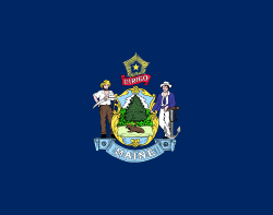
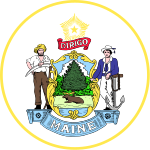
| Motto(s): "Dirigo" (Latin for "I lead", "I guide", or "I direct") | |
| Anthem: State of Maine | |
 Map of the United States with Maine highlighted | |
| Country | United States |
| Before statehood | Part of Massachusetts (District of Maine) |
| Admitted to the Union | March 15, 1820 (23rd) |
| Capital | Augusta |
| Largest city | Portland |
| Largest county or equivalent | Cumberland |
| Largest metro and urban areas | Portland |
| Government | |
| • Governor | Janet Mills (D) |
| • Senate President | Mattie Daughtry (D)[nb 1] |
| Legislature | State Legislature |
| • Upper house | Senate |
| • Lower house | House of Representatives |
| Judiciary | Maine Supreme Judicial Court |
| U.S. senators | Susan Collins (R) Angus King (I) |
| U.S. House delegation | 1. Chellie Pingree (D) 2. Jared Golden (D) (list) |
| Area | |
• Total | 35,385[2] sq mi (91,646 km2) |
| • Land | 30,862 sq mi (80,005 km2) |
| • Water | 4,523 sq mi (11,724 km2) 13.5% |
| • Rank | 39th |
| Dimensions | |
| • Length | 320 mi (515 km) |
| • Width | 205 mi (330 km) |
| Elevation | 600 ft (180 m) |
| Highest elevation | 5,270 ft (1,606.4 m) |
| Lowest elevation | 0 ft (0 m) |
| Population (2020) | |
• Total | 1,362,359 |
| • Rank | 42nd |
| • Density | 43.8/sq mi (16.9/km2) |
| • Rank | 38th |
| • Median household income | $56,277[5] |
| • Income rank | 35th |
| Demonym | Mainer |
| Language | |
| • Spoken language | |
| Time zone | UTC−05:00 (Eastern) |
| • Summer (DST) | UTC−04:00 (EDT) |
| USPS abbreviation | ME |
| ISO 3166 code | US-ME |
| Traditional abbreviation | Me. |
| Latitude | 42° 58′ N to 47° 28′ N |
| Longitude | 66° 57′ W to 71° 5′ W (45°N 69°W / 45°N 69°W) |
| Website | maine |
| List of state symbols | |
|---|---|
 | |
 | |
| Motto | Dirigo |
| Slogan | The Way Life Should Be |
| Song |
|
| Living insignia | |
| Bird | Black-capped chickadee |
| Butterfly | Pink-edged Sulphur |
| Cat breed | Maine Coon |
| Crustacean | Lobster |
| Fish | Landlocked Atlantic salmon |
| Flower | White pine cone and tassel |
| Fruit | Wild blueberry |
| Insect | Honey bee |
| Mammal | Moose |
| Plant | Wintergreen |
| Tree | White pine |
| Inanimate insignia | |
| Beverage | Moxie[7] |
| Food | Blueberry pie Whoopie pie |
| Fossil | Pertica quadrifaria |
| Gemstone | Tourmaline |
| Rock | Granitic pegmatite[8] |
| Ship | Bowdoin |
| Soil | Chesuncook soil |
| State route marker | |
 | |
| State quarter | |
 Released in 2003 | |
| Lists of United States state symbols | |
Maine (/meɪn/ MAYN)[9] is a state in the New England region of the United States, and the northeastern most state in the Lower 48. It borders New Hampshire to the west, the Gulf of Maine to the southeast, and the Canadian provinces of New Brunswick and Quebec to the northeast and northwest, and shares a maritime border with Nova Scotia. Maine is the largest state in New England by total area, nearly larger than the combined area of the remaining five states. Of the 50 U.S. states, it is the 12th-smallest by area, the 9th-least populous, the 13th-least densely populated, and the most rural.[10] Maine's capital is Augusta, and its most populous city is Portland, with a total population of 68,408, as of the 2020 census.
The territory of Maine has been inhabited by Indigenous populations[11] for about 12,000 years,[12] after the glaciers retreated during the last ice age. At the time of European arrival, several Algonquian-speaking nations governed the area and these nations are now known as the Wabanaki Confederacy. The first European settlement in the area was by the French in 1604 on Saint Croix Island, founded by Pierre Dugua, Sieur de Mons. The first English settlement was the short-lived Popham Colony, established by the Plymouth Company in 1607. A number of English settlements were established along the coast of Maine in the 1620s, although the rugged climate and conflict with the local Indigenous people caused many to fail. As Maine entered the 18th century, only a half dozen European settlements had survived. Loyalist and Patriot forces contended for Maine's territory during the American Revolution. During the War of 1812, the largely undefended eastern region of Maine was occupied by British forces with the goal of annexing it to Canada via the Colony of New Ireland, but returned to the United States following failed British offensives on the northern border, mid-Atlantic and south which produced a peace treaty that restored the pre-war boundaries. Maine was part of the Commonwealth of Massachusetts until 1820 when it voted to secede from Massachusetts to become a separate state. On March 15, 1820, under the Missouri Compromise, Maine was admitted to the Union as the 23rd state.
Today, Maine is known for its jagged, rocky Atlantic Ocean and bay-shore coastlines, mountains, heavily forested interior, and its cuisine, particularly wild lowbush blueberries and seafood such as lobster and clams. Coastal and Down East Maine have emerged as important centers for the creative economy,[13] especially in the vicinity of Portland, which has also brought gentrification to the city and its metropolitan area.[14]
- ^ "Maine for Vacation". USA Today. Retrieved August 5, 2013.
There's a reason it's called "Vacationland" ...
- ^ "State Area Measurements and Internal Point Coordinates". Census.gov.
- ^ "Katahdin 2". NGS Data Sheet. National Geodetic Survey, National Oceanic and Atmospheric Administration, United States Department of Commerce. Retrieved October 20, 2011.
- ^ a b "Elevations and Distances in the United States". United States Geological Survey. 2001. Archived from the original on October 15, 2011. Retrieved October 21, 2011.
- ^ "Median Annual Household Income". The Henry J. Kaiser Family Foundation. September 22, 2017. Retrieved December 9, 2016.
- ^ "Data Center Results". Modern Language Association. Archived from the original on November 3, 2023. Retrieved November 3, 2023.
- ^ "Title 1, §224: State soft drink". legislature.maine.gov.
- ^ "LD 269, SP 128, Text and Status, 131st Legislature, First Regular Session".
- ^ "Maine". Merriam-Webster.com Dictionary. Merriam-Webster.
- ^ Wickenheiser, Matt (March 26, 2012). "Census: Maine most rural state in 2010 as urban centers grow nationwide". Bangor Daily News. Archived from the original on April 23, 2021. Retrieved September 20, 2021.
- ^ "Indigenous Peoples of North America". www.gale.com. Retrieved December 17, 2023.
- ^ "Wabanaki Nations". National Park Service. Retrieved August 26, 2024.
- ^ "Maine's Creative Economy". Maine Arts Commission. Archived from the original on October 5, 2021. Retrieved October 5, 2021.
- ^ Currie, Ron (January 16, 2017). "Welcome to Portlyn". Down East Magazine. Archived from the original on October 6, 2021. Retrieved October 6, 2021.
Cite error: There are <ref group=nb> tags on this page, but the references will not show without a {{reflist|group=nb}} template (see the help page).
Previous Page Next Page


