Our website is made possible by displaying online advertisements to our visitors.
Please consider supporting us by disabling your ad blocker.
Manangatang
| Manangatang Victoria | |||||||||||||||
|---|---|---|---|---|---|---|---|---|---|---|---|---|---|---|---|
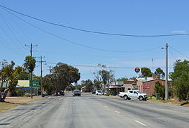
 Wattle Street, the main street of Manangatang | |||||||||||||||
| Coordinates | 35°03′0″S 142°52′0″E / 35.05000°S 142.86667°E | ||||||||||||||
| Population | 274 (2021 census)[1] | ||||||||||||||
| Postcode(s) | 3546 | ||||||||||||||
| Elevation | 56 m (184 ft) | ||||||||||||||
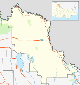
| Location | |||||||||||||||
| LGA(s) | Rural City of Swan Hill | ||||||||||||||
| State electorate(s) | Mildura | ||||||||||||||
| Federal division(s) | Mallee | ||||||||||||||
| |||||||||||||||
Manangatang (/məˈnæŋɡətæŋ/ mə-NANG-gə-tang) is a town in north-western Victoria, Australia. At the 2021 census, Manangatang had a population of 274.[1] It is sometimes noted for its unusual name, from an Aboriginal term "manang" meaning land and "kaaiti" meaning water.
- ^ a b Australian Bureau of Statistics (28 June 2022). "Manangatang (State Suburb)". 2021 Census QuickStats. Retrieved 10 April 2023.
Previous Page Next Page


