Our website is made possible by displaying online advertisements to our visitors.
Please consider supporting us by disabling your ad blocker.
Medchal-Malkajgiri district
Medchal–Malkajgiri district | |
|---|---|
|
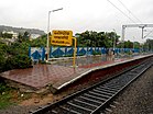
Clockwise from top: Shamirpet Lake, BITS Pilani - Hyderabad Campus, Malkajgiri railway station, Rock formations near Medchal, Cricket stadium at Uppal | |
 Location in Telangana | |
| Country | |
| State | |
| Established | 30 November 2016 |
| Headquarters | Shamirpet |
| Mandalas | 15 |
| Government | |
| • District collector | Sri V. Venkateswarlu, IAS |
| • Parliament constituencies | 1 (Malkajgiri) |
| • Assembly constituencies | 9
Medchal, Malkajgiri, Quthbullapur, Kukatpally, Uppal,Lal Bahadur(L.B) Nagar,Secunderabad Cantt. |
| Area | |
• Total | 1,084 km2 (419 sq mi) |
| Population (2020) | |
• Total | 2,440,073 |
| • Density | 2,300/km2 (5,800/sq mi) |
| • Urban | 2,230,245 (91.40% Urbanized district) |
| Demographics | |
| • Literacy | 82.49 |
| • Sex ratio | 957 |
| Time zone | UTC+05:30 (IST) |
| Vehicle registration | TG–08[1] |
| Major highways | NH-44, NH-65, NH-163 |
| Nominal GDP (2022-23) | ₹88,866.72 crore (US$11 billion) [2] |
| Per Capita Income (2022-23) | ₹295,514 (US$3,500) |
| Website | medchal-malkajgiri |
Medchal−Malkajgiri district is a district in the Indian state of Telangana. Shamirpet is the headquarter of the district.[3][4] It is the second most populous district in the state with a population of 2.5 million and also 91.40% urbanized district in the state of Telangana, standing next only to Hyderabad district which has a population of 4 million. The district shares boundaries with Hyderabad, Medak, Sangareddy, Y. Bhuvanagiri, Siddipet and Rangareddy districts.The most part of the district consist of Hyderabad City (GHMC)
- ^ "District Codes". Government of Telangana, Transport Department.
- ^ url=https://www.telangana.gov.in/wp-content/uploads/2024/07/Telangana-Socio-Economic-Outlook-2024.pdf
- ^ "ఘనంగా ఆవిర్భావ సంబురాలు". Retrieved 12 October 2017.
- ^ "Medchal−Malkajgiri district" (PDF). New Districts Formation Portal. Government of Telangana. Archived from the original (PDF) on 30 November 2016. Retrieved 23 March 2017.
Previous Page Next Page


