Our website is made possible by displaying online advertisements to our visitors.
Please consider supporting us by disabling your ad blocker.
Monmouthshire (historic)
| Monmouthshire Sir Fynwy (Welsh) | |
|---|---|
 Flag adopted in 2011 | |
| Area | |
| • 1831 | 324,310 acres (1,312.4 km2) |
| • 1901 | 345,048 acres (1,396.36 km2)[1] |
| • 1961 | 339,088 acres (1,372.24 km2)[1] |
| Population | |
| • 1831 | 98,130[2] |
| • 1901 | 230,806[1] |
| • 1961 | 444,679[1] |
| Density | |
| • 1831 | 0.3/acre |
| • 1901 | 0.7/acre |
| • 1961 | 1.3/acre |
| History | |
| • Origin | Laws in Wales Act 1535 |
| • Created | 1535 |
| • Succeeded by | Gwent, Mid Glamorgan, South Glamorgan |
| Status | Historic county Ceremonial county (until 1974) Administrative county (1889–1974) |
| Chapman code | MON |
| Government | Monmouthshire County Council (1889–1974) Newport County Borough Council (1891–1974) Cardiff County Borough Council (part) (1938–1974) |
| • HQ | Monmouth and Newport |
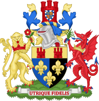
| • Motto | Faithful to both (Utrique Fidelis) |
 Coat of arms of Monmouthshire County Council | |
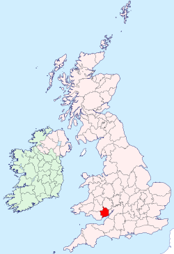
Monmouthshire (/ˈmɒnməθʃər, ˈmʌn-, -ʃɪər/ MON-məth-shər, MUN-, -sheer), also formerly known as the County of Monmouth (/ˈmɒnməθ, ˈmʌn-/ MON-məth, MUN-; Welsh: Sir Fynwy), was one of the thirteen historic counties of Wales in the south-east of Wales, on the border with England. Its area now corresponds approximately to the present principal areas of Monmouthshire, Blaenau Gwent, Newport and Torfaen, and those parts of Caerphilly and Cardiff east of the Rhymney River.
The eastern part of the county was mainly agricultural, while the western valleys had rich mineral resources. This led to the area becoming highly industrialised with coal mining and iron working being major employers from the 18th century to the late 20th century. Its five largest towns were Newport, Cwmbran, Pontypool, Ebbw Vale and Abergavenny.
Monmouthshire's Welsh status was ambiguous between the 16th and 20th centuries, with it considered by some to be part of England during this time; its legal inclusion in Wales was clarified by the Local Government Act 1972, the same act that changed the structure of local government within the county.
- ^ a b c d Vision of Britain – Monmouthshire population (area and density)
- ^ Vision of Britain – 1831 Census
Previous Page Next Page


