Our website is made possible by displaying online advertisements to our visitors.
Please consider supporting us by disabling your ad blocker.
Monroe County, Florida
Parts of this article (those related to rebuilding following hurricanes, specifically the 2017 Hurricane Irma, and developing discussions of urban resilience, climate resilience, and planning) need to be updated. (September 2017) |
Monroe County | |
|---|---|
 The Monroe County Courthouse in Key West | |
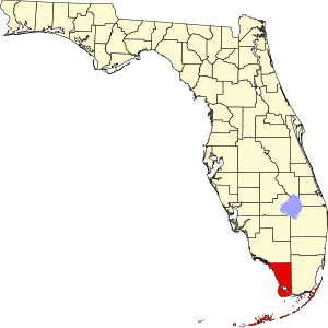
 Location within the U.S. state of Florida | |
 Florida's location within the U.S. | |
| Coordinates: 25°07′N 81°09′W / 25.12°N 81.15°W | |
| Country | |
| State | |
| Founded | July 3, 1823 |
| Named for | James Monroe |
| Seat | Key West |
| Largest city | Key West |
| Area | |
• Total | 3,738 sq mi (9,680 km2) |
| • Land | 983 sq mi (2,550 km2) |
| • Water | 2,754 sq mi (7,130 km2) 73.7% |
| Population (2020) | |
• Total | 82,874 |
• Estimate (2023) | 80,614 |
| • Density | 22/sq mi (8.6/km2) |
| Time zone | UTC−5 (Eastern) |
| • Summer (DST) | UTC−4 (EDT) |
| Congressional district | 28th |
| Website | www |
Monroe County is the southernmost county of the state of Florida.[1] As of the 2020 census, the population was 82,874.[2] Its county seat is Key West.[3] Monroe County includes the islands of the Florida Keys and comprises the Key West-Key Largo Micropolitan Statistical Area. Over 99.9% of the county's population lives on the Florida Keys. The mainland, which is part of the Everglades, comprises 87% of the county's land area and is virtually uninhabited with only 17 people recorded in the 2020 census.[4]
- ^ "About Monroe County | Monroe County, FL - Official Website".
- ^ Cite error: The named reference
censuswas invoked but never defined (see the help page). - ^ "Find a County". National Association of Counties. Retrieved June 7, 2011.
- ^ "Census Reporter Profile page for Census Tract 9800, Monroe, FL". U.S. Census Bureau. American Community Survey 5-year estimates. 2018. Retrieved March 30, 2020.
Previous Page Next Page
مقاطعة مونرو (فلوريدا) Arabic مونرو بؤلگهسی، فلوریدا AZB Monroe County, Florida BAR Монро (окръг, Флорида) Bulgarian মনরৌ কাউন্টি, ফ্লোরিডা BPY Monroe Gông (Florida) CDO Монро (гуо, Флорида) CE Monroe County (kondado sa Tinipong Bansa, Florida) CEB Monroe County, Florida CY Monroe County (Florida) Danish


