Our website is made possible by displaying online advertisements to our visitors.
Please consider supporting us by disabling your ad blocker.
Nasriganj
This article needs additional citations for verification. (October 2007) |
Nasriganj
Nāsriganj | |
|---|---|
Nagar panchayat town | |
 | |
| Coordinates: 25°03′05″N 84°19′42″E / 25.0514°N 84.32839°E[1] | |
| Country | India |
| State | Bihar |
| District | Rohtas |
| Languages | |
| • Official | Bhojpuri, Hindi, Urdu |
| Time zone | UTC5:30 (IST) |
| PIN | 821310 |
| Telephone code | 06185 |
| Vehicle registration | BR 24 |
| Nearest city | Dehri/Sasaram |
| Lok Sabha constituency | Karakat |
| Vidhan Sabha constituency | Nokha |
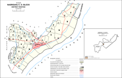
Nasriganj (Hindi: नासरीगंज) is a nagar panchayat town and corresponding community development block situated in Rohtas District of Bihar, India. Located on the banks of the Son River, the town was a vibrant economic hub in the late 19th century. The town of Nasriganj had a population of 23,819, according to the 2011 Census of India, while the total population of Nasriganj block was 115,117. Besides the town of Nasriganj itself, the block consisted of 53 villages, of which 50 were inhabited and 3 were uninhabited.[2]
- ^ "Geonames.org. Nāsriganj". Retrieved 15 April 2020.
- ^ Cite error: The named reference
Census 2011was invoked but never defined (see the help page).
Previous Page Next Page


