Our website is made possible by displaying online advertisements to our visitors.
Please consider supporting us by disabling your ad blocker.
Nawanagar, Bihar
This article needs additional citations for verification. (March 2014) |
Nawanagar | |
|---|---|
village | |
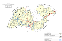
 Map showing Nawanagar in Nawanagar block | |
| Coordinates: 25°23′10″N 84°12′25″E / 25.38611°N 84.20694°E[2] | |
| State | Bihar |
| District | Buxar district[1] |
| Area | |
• Total | 3.901 km2 (1.506 sq mi) |
| Population (2011)[3] | |
• Total | 8,521 |
| • Density | 2,200/km2 (5,700/sq mi) |
| Languages | |
| • Official | Bhojpuri Hindi |
| Time zone | UTC+5:30 (IST) |
| ISO 3166 code | IN-BR |
| Nearest city | Dumraon |
| Literacy | 61% |
| Lok Sabha constituency | Buxar |
| Mukhiya (Village head) | Sudarshan Prasad Gupta |
Nawanagar is a village and corresponding community development block situated in the Buxar district of Bihar, India,[4][5] and one of the developing settlements of the district. It is one of several minor villages governed and administered by the Nawanagar panchayat. The village has the only chauki (police station) among other nearby villages. Nawangar is one of the seven blocks making up the Dumraon sub-division.[5]
As of 2011, the population of Nawanagar is 8,521, in 1,429 households, while the total population of the block is 166,534, in 25,557 households.[3]
- ^ Nawanagar in the Buxar District (PDF)
- ^ "Map of Nawanagar". google.co.in. Retrieved 22 July 2017.
- ^ a b c "Census of India 2011: Bihar District Census Handbook - Buxar, Part A (Village and Town Directory)". Census 2011 India. pp. 19–20, 23–98, 614–661, 681–82, 730–746. Retrieved 24 July 2020.
- ^ Nawanagar in Bihar
- ^ a b All about Bihar villages
Previous Page Next Page


