Our website is made possible by displaying online advertisements to our visitors.
Please consider supporting us by disabling your ad blocker.
Ogo Mountains
This article needs additional citations for verification. (December 2018) |
| Ogo Mountains Galgodon Highlands[1] Buuraha Oogo جَبَل أوغو | |
|---|---|
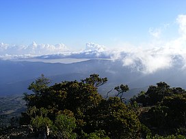
 Cal Madow, a subrange of the Ogo Mountains | |
| Highest point | |
| Peak | Shimbiris |
| Elevation | 2,450 m (8,040 ft) |
| Coordinates | 10°44′03.3″N 47°13′56.6″E / 10.734250°N 47.232389°E |
| Geography | |
| Country | |
| Regions | Sanaag and Togdheer |
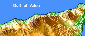
The Ogo Mountains (Ogo Highlands), also known as the Galgodon Highlands,[1] (Somali: Buuraha Oogo, Arabic: جبل أوغو) are a mountain range in the country of Somaliland. They cross the Sanaag and Togdheer regions. With a mean peak height of 2,450 m (8,040 ft), the ecology of this landform is semi-desert.
According to the CULTURAL ORIENTATION SOMALI published by the Defense Language Institute in 2020, the Golis Mountains is another name for the Galgala Hills, part of the Karkaar mountain range, and the Ogo Highlands are south of the Karkaar mountain range.[2] However, the areas to which these place names refer vary from literature to literature.
- ^ a b "Galgodon Highlands". Encyclopædia Britannica. Retrieved 25 June 2013.
- ^ DEFENSE LANGUAGE INSTITUTE FOREIGN LANGUAGE CENTER TECHNOLOGY INTEGRATION (2020). "CULTURAL ORIENTATION SOMALI" (PDF). Retrieved 2 May 2023.
Previous Page Next Page


