Our website is made possible by displaying online advertisements to our visitors.
Please consider supporting us by disabling your ad blocker.
Oistins
Oistins | |
|---|---|
City | |
 | |
| Coordinates: 13°3′52″N 59°32′40″W / 13.06444°N 59.54444°W | |
| Country | |
| Parish | Christ Church |
| Population (2013)[1] | |
• Total | 2,285 |
| Time zone | UTC-4 (Eastern Caribbean Time Zone) |
| Area code | +1 246 |
Preview warning: Page using Template:Infobox settlement with unknown parameter "population_density_sq_km"
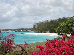
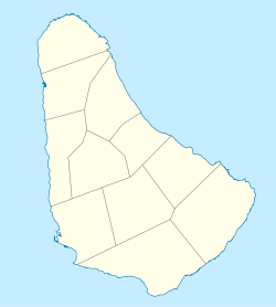
Oistins (Pronounced /'ȯis-tins/ -- UN/LOCODE: BB OST[2]) is a coastal area located in the country of Barbados. It is situated centrally along the coastline of the parish of Christ Church, and is the parish capital. The area includes a fishing village as well as a tourist area with a variety of bars, rum shops, and shopping arcades.
- ^ "World population data".
- ^ Barbados codes, United Nations - Code for Trade and Transport Locations (UN/LOCODE) via UNECE
Previous Page Next Page


