Our website is made possible by displaying online advertisements to our visitors.
Please consider supporting us by disabling your ad blocker.
Omo River
| Omo River | |
|---|---|
 Omo River near Omorati | |
 | |
| Location | |
| Country | Ethiopia |
| Regions | SNNPR, Oromia |
| Physical characteristics | |
| Source | Ethiopian Highlands |
| • coordinates | 7°48′43″N 36°53′56″E / 7.81194°N 36.89889°E |
| • elevation | 2,281 m (7,484 ft) |
| Mouth | Lake Turkana |
• coordinates | 4°29′48.8″N 36°0′49.7″E / 4.496889°N 36.013806°E |
• elevation | 388 m (1,273 ft) |
| Length | 1,104 km (686 mi)[1] |
| Basin size | 86,657 km2 (33,459 sq mi)[1] |
| Discharge | |
| • location | Mouth[1] |
| • average | 915.5 m3/s (32,330 cu ft/s) |
| • minimum | 164.6 m3/s (5,814 cu ft/s) |
| • maximum | 2,295 m3/s (81,030 cu ft/s) |
| Basin features | |
| River system | Omo Basin |
| Population | 15,500,000[2] |
| Tributaries | |
| • left | Gibe, Usno, Wabe |
| • right | Gojeb, Denchya, Mui, Mantsa, Zigina |
| UNESCO World Heritage Site | |
|---|---|
| Location | Ethiopia |
| Criteria | Cultural: (iii)(iv) |
| Reference | 17 |
| Inscription | 1980 (4th Session) |
| Coordinates | 4°48′N 35°58′E / 4.800°N 35.967°E |
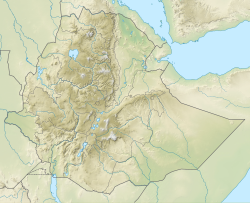
The Omo River (Amharic: ኦሞ ወንዝ, romanized: Omo Wenz; also called Omo-Bottego) in southern Ethiopia is the largest Ethiopian river outside the Nile Basin. Its course is entirely contained within the boundaries of Ethiopia, and it empties into Lake Turkana on the border with Kenya. The river is the principal stream of an endorheic drainage basin, the Turkana Basin.
The river basin is famous for its large number of early hominid fossils and archeological findings such as early stone tools, leading to its inclusion on the UNESCO World Heritage List in 1980.[3]
- ^ a b c Cite error: The named reference
HydroSHEDSwas invoked but never defined (see the help page). - ^ Liu, L., Cao, X., Li, S., & Jie, N. (2023). GlobPOP: A 31-year (1990-2020) global gridded population dataset generated by cluster analysis and statistical learning (1.0) [Data set]. Zenodo. https://doi.org/10.5281/zenodo.10088105
- ^ "Lower Valley of the Omo". UNESCO World Heritage Centre. United Nations Educational, Scientific, and Cultural Organization. Retrieved 18 September 2021.
Previous Page Next Page


