Our website is made possible by displaying online advertisements to our visitors.
Please consider supporting us by disabling your ad blocker.
Orkdal
Orkdal Municipality
Orkdal kommune | |
|---|---|
| Orkedal herred (historic name) Orkedalen herred (historic name) | |
 View of Orkanger | |
|
| |
 Trøndelag within Norway | |
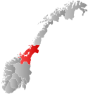
 Orkdal within Trøndelag | |
| Coordinates: 63°17′20″N 09°43′34″E / 63.28889°N 9.72611°E | |
| Country | Norway |
| County | Trøndelag |
| District | Orkdalen |
| Established | 1 Jan 1838 |
| • Created as | Formannskapsdistrikt |
| Disestablished | 1 Jan 2020 |
| • Succeeded by | Orkland Municipality |
| Administrative centre | Orkanger |
| Government | |
| • Mayor (2015–2019) | Oddbjørn Bang (Sp) |
| Area (upon dissolution) | |
• Total | 594.32 km2 (229.47 sq mi) |
| • Land | 564.49 km2 (217.95 sq mi) |
| • Water | 29.83 km2 (11.52 sq mi) 5% |
| • Rank | #188 in Norway |
| Population (2018) | |
• Total | 11,933 |
| • Rank | #97 in Norway |
| • Density | 21.1/km2 (55/sq mi) |
| • Change (10 years) | |
| Demonym | Orkdaling[1] |
| Official language | |
| • Norwegian form | Neutral |
| Time zone | UTC+01:00 (CET) |
| • Summer (DST) | UTC+02:00 (CEST) |
| ISO 3166 code | NO-5024[3] |
| Website | Official website |
Orkdal is a former municipality in Trøndelag county, Norway. The municipality existed from 1838 until its dissolution in 2020 when it joined Orkland Municipality. It was part of the Orkdalen region. The administrative centre of the municipality was the city of Orkanger. Some of the notable villages in the municipality included Kjøra, Geitastrand, Gjølme, Thamshavn, Fannrem, Vormstad, Svorkmo, and Hoston.
Agriculture plays a significant role in the municipality. The Thamshavnbanen was used to transport ore from Løkken Verk to the port of Thamshavn, and is now a vintage railway. The Fannrem concentration camp was located in Fannrem during World War II. Orkanger is one of the main industrial hubs in central Norway. The industry is mainly located around Grønøra Industrial park. The largest companies are Technip Offshore Norge AS, Reinertsen, Washington Mills and Elkem Thamshavn AS.

At the time of its dissolution in 2020, the 594-square-kilometre (229 sq mi) municipality was the 188th largest by area out of the 422 municipalities in Norway. Orkdal was the 97th most populous municipality in Norway with a population of 11,933. The municipality's population density was 21.1 inhabitants per square kilometre (55/sq mi) and its population had increased by 8.3% over the last decade.[4][5]
- ^ "Navn på steder og personer: Innbyggjarnamn" (in Norwegian). Språkrådet.
- ^ "Forskrift om målvedtak i kommunar og fylkeskommunar" (in Norwegian). Lovdata.no.
- ^ Bolstad, Erik; Thorsnæs, Geir, eds. (26 January 2023). "Kommunenummer". Store norske leksikon (in Norwegian). Kunnskapsforlaget.
- ^ Statistisk sentralbyrå (2018). "Table: 06913: Population 1 January and population changes during the calendar year (M)" (in Norwegian). Retrieved 18 March 2019.
- ^ Statistisk sentralbyrå. "09280: Area of land and fresh water (km²) (M)" (in Norwegian). Retrieved 18 March 2019.
Previous Page Next Page


