Our website is made possible by displaying online advertisements to our visitors.
Please consider supporting us by disabling your ad blocker.
Oxnard Airport
Oxnard Airport Ventura County Army Airfield | |||||||||||
|---|---|---|---|---|---|---|---|---|---|---|---|
 USGS 2006 orthophoto | |||||||||||
| Summary | |||||||||||
| Airport type | Public | ||||||||||
| Owner | County of Ventura | ||||||||||
| Serves | Oxnard, California | ||||||||||
| Elevation AMSL | 45 ft / 14 m | ||||||||||
| Coordinates | 34°12′03″N 119°12′26″W / 34.20083°N 119.20722°W | ||||||||||
| Maps | |||||||||||
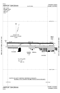
 FAA airport diagram | |||||||||||
 | |||||||||||
| Runways | |||||||||||
| |||||||||||
| Statistics (2010) | |||||||||||
| |||||||||||
Oxnard Airport (IATA: OXR, ICAO: KOXR, FAA LID: OXR) is a county-owned, public airport a mile west of downtown Oxnard, in Ventura County, California.[1] The airport has not had scheduled passenger service since June 8, 2010, when United Express (operated via a code sharing agreement with United Airlines by SkyWest Airlines) ended flights to Los Angeles International Airport. America West Express also served the airport with nonstop flights to Phoenix in the early-2000s via a code sharing agreement with America West Airlines.[2]
Federal Aviation Administration records say the airport had 15,961 passenger boardings (enplanements) in calendar year 2008,[3] 12,060 in 2009 and 4,074 in 2010.[4] The National Plan of Integrated Airport Systems for 2011–2015 called it a primary commercial service airport based on enplanements in 2008 (over 10,000 per year).[5] By the time of the next NPIAS report, for 2015–2019, Oxnard Airport had been downgraded to a regional general aviation airport with only 19 enplanements.[6]
- ^ a b FAA Airport Form 5010 for OXR PDF. Federal Aviation Administration. Effective April 5, 2012.
- ^ "United Express plans to end service to Oxnard Airport". Los Angeles Times. March 16, 2010.
- ^ "Enplanements for CY 2008" (PDF, 1.0 MB). CY 2008 Passenger Boarding and All-Cargo Data. Federal Aviation Administration. December 18, 2009.
- ^ "Enplanements for CY 2010" (PDF, 189 KB). CY 2010 Passenger Boarding and All-Cargo Data. Federal Aviation Administration. October 4, 2011.
- ^ "2011–2015 NPIAS Report, Appendix A" (PDF, 2.03 MB). National Plan of Integrated Airport Systems. Federal Aviation Administration. October 4, 2010.
- ^ "2015–2019 NPIAS Report, Appendix A" (PDF, 7.89 MB). faa.gov. Federal Aviation Administration. January 20, 2015.
Previous Page Next Page


