Our website is made possible by displaying online advertisements to our visitors.
Please consider supporting us by disabling your ad blocker.
Parbhani district
Parbhani
प्रभावतीनगरी | |
|---|---|
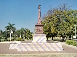
 Memorial to freedom fighters from Marathwada in Parbhani city | |
| Nickname: Land of saints | |
 Location in Maharashtra | |
| Coordinates (Parbhani): 19°30′N 76°45′E / 19.500°N 76.750°E | |
| Country | |
| State | Maharashtra |
| Division | Aurangabad |
| Headquarters | Parbhani |
| Tehsils | 1. Parbhani, 2. Gangakhed, 3. Sonpeth, 4. Pathri, 5. Manwath, 6. Palam, 7. Sailu, 8. Jintur, 9. Purna |
| Government | |
| • Body | Parbhani Zilla Parishad |
| • Guardian Minister | Sanjay Bansode (Cabinet Minister) |
| • President Z. P. Parbhani | NA |
| • District Collector | Mr. D. M. Mugalikar IAS |
| • CEO Z. P. Parbhani | NA |
| • MPs | Sanjay Haribhau Jadhav (Parbhani) |
| Area | |
• Total | 6,251 km2 (2,414 sq mi) |
| Population (2011) | |
• Total | 1,636,086[1] |
| Demonym | Parbhanikar |
| Demographics | |
| • Literacy | 75.22% |
| • Sex ratio | 940 |
| Time zone | UTC+05:30 (IST) |
| Major highways | NH 61[2] |
| Website | parbhani |

Parbhani district (Marathi pronunciation: [pəɾbʰəɳiː] ⓘ) is one of the eight districts in the Marathawada region of Maharashtra state of India. Parbhani city is the headquarters of this district. Parbhani district is well known for the Marathwada rebellion and religious tourism of Hinduism, Jainism.
- ^ "Parbhani District : Census 2011 data". Retrieved 9 October 2012.
- ^ "NH 61". Wikimapia. Retrieved 12 May 2015.
Previous Page Next Page


