Our website is made possible by displaying online advertisements to our visitors.
Please consider supporting us by disabling your ad blocker.
Piedmont, South Carolina
Piedmont | |
|---|---|
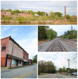
 Top, left to right: Ruins of the Piedmont Number One overlooking the Saluda River, Main Street, Railroad, Piedmont Highway | |
 Location of Piedmont, South Carolina | |
| Coordinates: 34°42′15″N 82°27′41″W / 34.70417°N 82.46139°W | |
| Country | United States |
| State | South Carolina |
| Counties | Anderson, Greenville |
| Area | |
• Total | 8.78 sq mi (22.73 km2) |
| • Land | 8.60 sq mi (22.26 km2) |
| • Water | 0.18 sq mi (0.46 km2) |
| Elevation | 791 ft (241 m) |
| Population | |
• Total | 5,411 |
| • Density | 629.48/sq mi (243.04/km2) |
| Time zone | UTC-5 (Eastern (EST)) |
| • Summer (DST) | UTC-4 (EDT) |
| ZIP code | 29673 |
| Area codes | 864, 821 |
| FIPS code | 45-56365[4] |
| GNIS feature ID | 1225406[2] |
Piedmont is a census-designated place (CDP) along the Saluda River in Anderson and Greenville counties in the U.S. state of South Carolina. The population was 5,411 at the 2020 census.[5]
Piedmont is a part of the Greenville-Anderson metropolitan area.
- ^ "ArcGIS REST Services Directory". United States Census Bureau. Retrieved October 15, 2022.
- ^ a b U.S. Geological Survey Geographic Names Information System: Piedmont, South Carolina
- ^ "Census Population API". United States Census Bureau. Retrieved October 15, 2022.
- ^ "U.S. Census website". United States Census Bureau. Retrieved January 31, 2008.
- ^ "Geographic Identifiers: 2010 Demographic Profile Data (G001): Piedmont CDP, South Carolina". U.S. Census Bureau, American Factfinder. Archived from the original on February 12, 2020. Retrieved August 8, 2013.
Previous Page Next Page
بييمونتي (كارولاينا الجنوبية) Arabic بييمونتى (منطقه فى امريكا) ARZ Piedmont (Carolina del Sud) Catalan Пьедмонт (Къилба Каролина) CE Piedmont (lungsod sa Tinipong Bansa, South Carolina) CEB Piedmont (South Carolina) German Piedmont (Carolina del Sur) Spanish پیدمانت، کارولینای جنوبی FA Piedmont (Caroline du sud) French پیدمانت (نسايي کارؤلينا) GLK


