Our website is made possible by displaying online advertisements to our visitors.
Please consider supporting us by disabling your ad blocker.

Puerto Rico Highway 438
 Highway 438 | ||||
|---|---|---|---|---|
| Ruta 438 | ||||
| Route information | ||||
| Maintained by Puerto Rico DTPW | ||||
| Length | 1.7 km[1] (1.1 mi) | |||
| Major junctions | ||||
| West end | ||||
| East end | Barrio Juncal | |||
| Location | ||||
| Country | United States | |||
| Territory | Puerto Rico | |||
| Municipalities | San Sebastián | |||
| Highway system | ||||
| ||||
Puerto Rico Highway 438 (PR-438) is a rural road located entirely in the municipality of San Sebastián, Puerto Rico.[2] With a length of 1.7 kilometers (1.1 mi),[1] it begins at its intersection with PR-111 on the Eneas–Cidral–Magos tripoint, and ends near PR-111 in Juncal barrio.[3]
-
 Cuesta de Magos (PR-438) in Magos barrio
 -
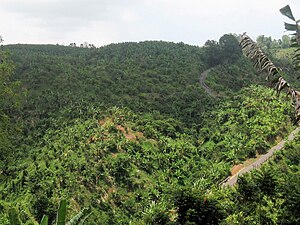 Cuesta de Magos seen from Calabazas barrio


- ^ a b Cite error: The named reference
googlewas invoked but never defined (see the help page). - ^ National Geographic Maps (2011). Puerto Rico (Map). 1:125,000. Adventure Map (Book 3107). Evergreen, Colorado: National Geographic Maps. ISBN 978-1566955188. OCLC 756511572.
- ^ "Carretera 438, San Sebastián, Puerto Rico". geoview.info. Retrieved 14 August 2020.
Previous Page Next Page

